


Overview
Spatial Information Research is an international interdisciplinary journal that publishes high-quality research articles in spatial information science.
- Covers technology, policy, and practice in the field of spatial information science.
- Explores both operational and computational issues of spatial information.
- Mixes academia and industry for a unique perspective on Spatial Information Science.
- Publishes a variety of article types, including original research articles, reviews and special case reports.
- Official journal of the Korea Spatial Information Society.
- Editor-in-Chief
-
- Jung-Sup Um
- Co-Editor-in-Chief
-
- Biswajeet Pradhan
- Impact factor
- 2.4 (2022)
- 5 year impact factor
- 2.1 (2022)
- Submission to first decision (median)
- 9 days
- Downloads
- 143,448 (2023)
Societies and partnerships

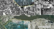
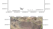
Latest articles

Journal updates
-
Announcing the KSIS Springer Award
The award is given annually to the first author of the most highly-cited paper published in Spatial Information Research over the previous two years, which could be calculated as Journal Impact Factor.
The winner will receive an award of 5,000 US dollars and a Springer book voucher to the value of 900 Euros. The first winner will be announced in November 2024.
-
The Korea Spatial Information Society (KSIS)
The Korea Spatial Information Society was established by integrating
Korea GIS Society and Korea Spatial Information System Society on March 19, 2010.
-
Journal promotion
We are currently promoting the journal on www.nature.com and sent out promotion emails to a thousand researchers in the relevant subject fields on November 16th.
-
Biswajeet Pradhan, one of the world's most highly cited researchers, joins as Co-Editor-in-Chief for Spatial Information Research.
We are delighted to welcome Professor Biswajeet Pradhan, to join Spatial Information Research as the Co-Editor-in-Chief. Professor Pradhan is the Director of the Centre for Advanced Modelling and Geospatial Information Systems (CAMGIS) at the Faculty of Engineering and IT, University of Technology Sydney (UTS). He is also a distinguished professor at the School of Civil and Environmental Engineering, UTS. His area of research are Geospatial Information Systems (GIS), remote sensing and image processing, complex modeling/geo-computing, machine learning, and soft-computing applications in natural hazards and environmental modeling, and remote sensing of Earth observation. He teaches various subjects such as Radar Image Processing, Remote Sensing and GIS Applications, GIS for Engineers, Disaster Forecasting, Hazard, Risks and Ethics, and Research Methodology.
With an H-index of 98 in Web of Science (WoS) database, he is listed as one of the world’s most Highly Cited Researchers by Clarivate Web of ScienceTM. Indeed, Professor Pradhan has enjoyed recognition as one of “the true pioneers in his research fields” for five consecutive years from 2016-2020.
Among 55 awards received since 2006 acknowledging his excellence in teaching, service and research, Professor Pradhan has been awarded the status of World Class Professor by the Ministry of Research, Technology and Higher Education, Indonesia, 2018 - 2020. He is a member of many international professional bodies including the Committee of Space research (COSPAR) and United Nations Outer Space Research Programme (UNOOSA).
We are very pleased that Professor Pradhan has joined as Co-Editor-in-Chief for Spatial Information Research. Thank him for his support. We are convinced that his extended international profile and remarkable experience will contribute to the further success of Spatial Information Research.
Journal information
- Electronic ISSN
- 2366-3294
- Print ISSN
- 2366-3286
- Abstracted and indexed in
-
- Astrophysics Data System (ADS)
- Baidu
- CLOCKSS
- CNKI
- CNPIEC
- Dimensions
- EBSCO
- EI Compendex
- Emerging Sources Citation Index
- Engineering Village – GEOBASE
- Google Scholar
- Japanese Science and Technology Agency (JST)
- Korea Citation Index (KCI)
- Naver
- OCLC WorldCat Discovery Service
- Portico
- ProQuest
- SCImago
- SCOPUS
- Semantic Scholar
- TD Net Discovery Service
- UGC-CARE List (India)
- Wanfang
- Copyright information