Comparison of Planimetric and Thematic Accuracy of OrbView-3 and IKONOS Images Mustafa YanalakElif SertelSinasi Kaya Research Article 12 February 2011 Pages: 135 - 146
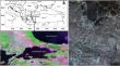
Spatio-Temporal Coherence Based Technique for Near-Real Time Sea-Ice Identification from Scatterometer Data Sandip R. OzaR. K. K. SinghAbhijit Sarkar Research Article 12 February 2011 Pages: 147 - 152
Improvement in Precision of Crop Acreage Estimation by Remote Sensing Using Frequency Distribution Based Stratification Nita BhagiaD. R. RajakN. K. Patel Research Article 03 June 2011 Pages: 153 - 160
Utility of Hyperspectral Data for Potato Late Blight Disease Detection Shibendu Shankar RayNamrata JainSushma Panigrahy Research Article 11 May 2011 Pages: 161 - 169
Assessing NDVI Spatial Pattern as Related to Irrigation and Soil Salinity Management in Al-Hassa Oasis, Saudi Arabia Yousef Y. Aldakheel Research Article 18 February 2011 Pages: 171 - 180
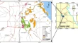
Quantitative Determination of Soil Erosion and Prioritization of Micro-Watersheds Using Remote Sensing and GIS Vipul ShindeArabinda SharmaManjushree Singh Research Article 12 February 2011 Pages: 181 - 192
Relationship Between Land Cover Ratio and Urban Heat Island from Remote Sensing and Automatic Weather Stations Data Xingping WenXiaofeng YangGuangdao Hu Research Article 12 February 2011 Pages: 193 - 201
Spatial Metrics to Analyse the Impact of Regional Factors on Pattern of Urbanisation in Gurgaon, India Sadhana JainDivyani KohliWietske Bijker Research Article 24 February 2011 Pages: 203 - 212
Evaluating the Long-term Urban Expansion of Ranchi Urban Agglomeration, India Using Geospatial Technology Amit KumarArvind Chandra PandeyA. T. Jeyaseelan Research Article 22 February 2011 Pages: 213 - 224
Quantification of Urban Landscape Dynamics Using Patch Parameters and Landscape Indices: An Analytical Study of Ranchi Pammi Nitin SinhaNilanchal PatelVivek K. Singh Research Article 12 February 2011 Pages: 225 - 233
Morphotectonics of the Area Around Renukoot, District Sonbhadra, U.P. Using Remote Sensing and GIS Techniques C. K. SinghVaibhava Srivastava Research Article 12 February 2011 Pages: 235 - 240
Application of Remote Sensing in Studying Holocene Sediments and Tectonic Episodes at Kelshi, Ratnagiri District, Maharashtra, India Ashok MaratheB. S. Chandrashekhar Research Article 12 February 2011 Pages: 241 - 247
Spatial Technologies in Deriving the Morphotectonic Characteristics of Tectonically Active Western Tripura Region, Northeast India J. D. DasYazdana ShujatA. K. Saraf Research Article 02 March 2011 Pages: 249 - 258
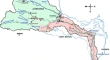
Water Balance Study for a Basin Integrating Remote Sensing Data and GIS Sanjay Kumar JainSharad K. JainAnju Choudhry Research Article 17 February 2011 Pages: 259 - 270
Reservoir Impact Assessment on Land Use/Land Cover and Infrastructure—A Case Study on Polavaram Project Devastu Ramprasad NaikSuryaprakasarao BosukondaKamireddy Mrutyunjayareddy Research Article 22 February 2011 Pages: 271 - 278