The Use of Artificial Neuron Networks for Retrieval Temperature and Humidity Sounding of the Atmosphere According to the Data of the MTVZA-GY Microwave Radiometer Installed on the Meteor-M No. 2-2 Satellite A. A. FileiA. I. AndreevA. B. Uspensky METHODS AND TOOLS FOR PROCESSING AND INTERPRETING SPACE INFORMATION 29 March 2022 Pages: 1515 - 1526
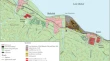
Methods of Radar Interferometry and Optical Satellite Image Processing to Study Negative Effects on the Environment (a Case Study of the Baikalsk Pulp and Paper Mill) V. G. BondurT. N. ChimitdorzhievP. N. Dagurov METHODS AND TOOLS FOR PROCESSING AND INTERPRETING SPACE INFORMATION 29 March 2022 Pages: 1527 - 1537
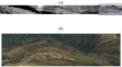
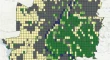
Identification of Forest Vegetation Using Airborne Hyperspectral Data V. D. EgorovV. V. Kozoderov METHODS AND TOOLS FOR PROCESSING AND INTERPRETING SPACE INFORMATION 29 March 2022 Pages: 1538 - 1548
Radar-Satellite-Survey-Data-Based Forest-Inventory Opportunities V. M. SidorenkovO. V. KusnirA. V. Bukas METHODS AND TOOLS FOR PROCESSING AND INTERPRETING SPACE INFORMATION 29 March 2022 Pages: 1549 - 1560
A Technique for Photogrammetric Estimation of Albedo of Snow–Ice Surfaces D. M. ZhuravskiyB. V. Ivanov METHODS AND TOOLS FOR PROCESSING AND INTERPRETING SPACE INFORMATION 29 March 2022 Pages: 1561 - 1565
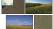
Spatiotemporal Spectral-Response Assessment of the Forest Cover of Small Dry Valleys in the Central Russian Forest–Steppe E. A. Terekhin METHODS AND TOOLS FOR PROCESSING AND INTERPRETING SPACE INFORMATION 29 March 2022 Pages: 1566 - 1575
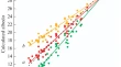
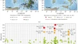
The Relationship between the Seasonal Dynamics of Surface Temperature and NDVI in Urbanized Areas of an Arid Zone. The Case of the Volgograd Agglomeration S. S. ShinkarenkoO. Yu. KoshelevaR. S. Omarov METHODS AND TOOLS FOR PROCESSING AND INTERPRETING SPACE INFORMATION 29 March 2022 Pages: 1576 - 1585
Dependence of the Normalized Difference Vegetation Index Level on the Spatial Structure of the Landscape and Its Time Variability Using the Example of the West End of the Crimean Peninsula (Tarkhankut Peninsula) S. M. Shadchinov METHODS AND TOOLS FOR PROCESSING AND INTERPRETING SPACE INFORMATION 29 March 2022 Pages: 1586 - 1595
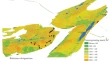
Assessment of Land-Use Efficiency in Agriculture with the Application of GIS Technologies E. V. Denisova METHODS AND TOOLS FOR PROCESSING AND INTERPRETING SPACE INFORMATION 29 March 2022 Pages: 1596 - 1603
A Study from Space of Anomalous Variations of Various Geophysical Fields during the Preparation of a Series of Strong Earthquakes in Italy in 2016–2017 V. G. BondurM. N. TsidilinaN. V. Feoktistova USE OF SPACE INFORMATION ABOUT THE EARTH STUDYING CATASTROPHIC NATURAL PROCESSES FROM SPACE 29 March 2022 Pages: 1604 - 1620
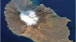
Uplift of the Crater Bottom of the Sarychev Peak Volcano (Matua Island, Kurils) in 2017–2019 Inferred from Satellite Images As a Precursor of an Upcoming Strong Eruption S. Yu. Grishin USE OF SPACE INFORMATION ABOUT THE EARTH STUDYING CATASTROPHIC NATURAL PROCESSES FROM SPACE 29 March 2022 Pages: 1621 - 1626
Mesoscale Eddies in the Bering Sea from Satellite Altimetry Data I. A. ZhabinE. V. DmitrievaS. N. Taranova USE OF SPACE INFORMATION ABOUT THE EARTH STUDYING SEAS AND OCEANS FROM SPACE 29 March 2022 Pages: 1627 - 1642
Seasonal and Interannual Variability of Chlorophyll-a Concentration in the Bering Sea Found from Satellite Data K. K. KivvaA. A. Kubryakov USE OF SPACE INFORMATION ABOUT THE EARTH STUDYING SEAS AND OCEANS FROM SPACE 29 March 2022 Pages: 1643 - 1657
Long-Term Tendencies of Intensity of Eastern Boundary Upwelling Systems Assessed from Different Satellite Data. Part 1: Atlantic Upwellings A. B. PolonskyA. N. Serebrennikov USE OF SPACE INFORMATION ABOUT THE EARTH STUDYING SEAS AND OCEANS FROM SPACE 29 March 2022 Pages: 1658 - 1669
Long-Term Tendencies of Intensity of Eastern-Boundary Upwelling Systems Assessed from Different Satellite Data. Part 2: Pacific Upwellings A. B. PolonskyA. N. Serebrennikov USE OF SPACE INFORMATION ABOUT THE EARTH STUDYING SEAS AND OCEANS FROM SPACE 29 March 2022 Pages: 1670 - 1679
Seasonal and Inter-Annual Variability of Wind-Driven Upwelling near the East Coast of Sakhalin Island Based on QuikSCAT/SeaWinds Scatterometer Data I. A. ZhabinE. V. Dmitrieva USE OF SPACE INFORMATION ABOUT THE EARTH STUDYING SEAS AND OCEANS FROM SPACE 29 March 2022 Pages: 1680 - 1689
Analysis of Sea-Ice Areas Undetectable by the ASI Algorithm Based on Satellite Microwave Radiometry in the Arctic Ocean T. A. AlekseevaJ. V. SokolovaE. A. Sharkov USE OF SPACE INFORMATION ABOUT THE EARTH STUDYING SEAS AND OCEANS FROM SPACE 29 March 2022 Pages: 1690 - 1704
Submesoscale Eddies in the White Sea Based on Satellite Radar Measurements A. V. ZiminO. A. AtazhanovaB. Chapron USE OF SPACE INFORMATION ABOUT THE EARTH STUDYING SEAS AND OCEANS FROM SPACE 29 March 2022 Pages: 1705 - 1711
Influence of Total Water-Temperature Value on the Size and Weight Characteristics of Pacific Oyster Crassostrea gigas (Thunberg, 1793) in the Aniva Bay (Sakhalin Island) According to Satellite Data A. Ch. KimD. M. Lozhkin USE OF SPACE INFORMATION ABOUT THE EARTH STUDYING SEAS AND OCEANS FROM SPACE 29 March 2022 Pages: 1712 - 1719
Studying the Dynamics of Wildfires in Russia in 2001–2020 Taking into Account Climatic Factors O. S. VoronovaK. A. GordoA. L. Zima USE OF SPACE INFORMATION ABOUT THE EARTH SPACE MONITORING OF CLIMATE-RELATED CHANGES 29 March 2022 Pages: 1720 - 1731
The Response of Vegetation Cover in the West Siberian Plain to Climate Changes in 1982–2015 E. M KorotkovaV. V. Zuev USE OF SPACE INFORMATION ABOUT THE EARTH SPACE MONITORING OF CLIMATE-RELATED CHANGES 29 March 2022 Pages: 1732 - 1740
Reflection of Mantle-Plume Magmatism Processes in Lithospheric Magnetic Anomalies according to CHAMP Satellite Data L. M. AbramovaD. Yu. Abramova USE OF SPACE INFORMATION ABOUT THE EARTH GEOLOGICAL STUDIES FROM SPACE 29 March 2022 Pages: 1741 - 1750
Application of Models of the Earth’s Crust-Depth Structure Based on GOCE Satellite Gravitational Data for Forecasting and Prospecting Pb–Zn Deposits in the Arctic Zone of Russia A. L. GalyamovA. V. VolkovK. V. Lobanov USE OF SPACE INFORMATION ABOUT THE EARTH GEOLOGICAL STUDIES FROM SPACE 29 March 2022 Pages: 1751 - 1761
Structural Control of Gold-Ore Mineralization for the Eastern Slope of the Polar Urals (Russia) Based on Analysis of Multispectral Images of the Landsat 8 Spacecraft J. N. IvanovaR. I. Vyhristenko USE OF SPACE INFORMATION ABOUT THE EARTH GEOLOGICAL STUDIES FROM SPACE 29 March 2022 Pages: 1762 - 1773
Use of High-Resolution Satellite Imagery in Prospecting for Coastal Placers and Deposits of Hydrocarbons in the Northern Seas of Russia G. A. MilovskyV. T. IshmukhametovaA. D. Aparin USE OF SPACE INFORMATION ABOUT THE EARTH GEOLOGICAL STUDIES FROM SPACE 29 March 2022 Pages: 1774 - 1782
Dielectric Model of Thawed and Frozen Organic Soil at the AMSR Radiometer Frequency V. L. MironovL. G. KosolapovaI. V. Savin PHYSICAL FOUNDATIONS OF EARTH EXPLORATION FROM SPACE 29 March 2022 Pages: 1783 - 1788
Combined Method of Radar Measurements of Surface Current Parameters M. D. RaevE. I. Skvortsov PHYSICAL FOUNDATIONS OF EARTH EXPLORATION FROM SPACE 29 March 2022 Pages: 1789 - 1793
Laser Applications in Ground-Based and Space Observations (Marking 60 Years since the First Experiments on Lunar Laser Ranging) A. V. IpatovL. A. Vedeshin SPACE VEHICLES AND SYSTEMS. EARTH-FROM-SPACE EXPLORATION PROGRAMS 29 March 2022 Pages: 1794 - 1796
The First Space Studies of the World Ocean and Atmosphere of the Earth (on the 60-Year Anniversary of the Start of Scientific Experiments on Satellites of the Kosmos and Interkosmos Series) L. A. Vedeshin SPACE VEHICLES AND SYSTEMS. EARTH-FROM-SPACE EXPLORATION PROGRAMS 29 March 2022 Pages: 1797 - 1799
The First Soviet Experiments on Remote Sensing and Contact Study of the Moon (on the 50th Anniversary of the Moon Landing of Lunokhod 1 Self-Propelled Vehicle) L. A. Vedeshin HISTORY 29 March 2022 Pages: 1800 - 1802
Russia–United States: 50 Years of Cooperation in Space (Results of Scientific and Technical Cooperation with the United States As Part of the Intercosmos Program) L. A. Vedeshin HISTORY 29 March 2022 Pages: 1803 - 1806