
Abstract
UNESCO World Heritage properties in Anatolia show a great variety in their land use morphologies as a response to their environmental differences, developing different ways of managing water for daily use and agricultural irrigation. History testifies to the many conflicts and wars that occurred in defending and/or accessing these important water resources. The remnants of this infrastructure form part of invaluable cultural heritage and present opportunities for the embodied traditional knowledge to mitigate the impacts of climate change. However, ruthless water regimes (i.e. hydroelectric plants), which disregard the importance of water for communities, have prioritized water as a source of energy over its value for daily and agricultural use and have impacted the environment and climate, which directly affects both tangible and intangible cultural heritage. Dried creeks leave water-related infrastructure and equipment without a purpose and people deprived of water. In the age of Anthropocene, such an approach victimizes people through the idea of taking over nature while at the same time making people the victims of nature’s response. In return, new regional conflicts are instigated, and migration becomes inevitable, diminishing neighbourly peace and also aggravating climate change, causing negative impacts on cultural heritage and jeopardising many of the UN Sustainable Development Goals.
You have full access to this open access chapter, Download chapter PDF
Keywords
1 Introduction
Civilization has evolved thanks to humanity’s ability to control water. The creative genius of humankind in relation to water manifests itself in water structures for collecting (wells, boreholes), storage (dams, open and closed cisterns), distribution (qanat, aqueducts, water pipes, reservoirs, water towers), presentation (fountains, ponds), sanitary and bathing facilities (pools and bathhouses), use of water for transportation (channels), water sanctuaries and water treatment systems, among others. The discovery of the water level alone, as an instrument that made it possible to build irrigational channels as well as exemplary structures such as pyramids and temples, is worthy of recognition. Thus, as water is essential to all living creatures, it is equally important to understand the role it plays in the development of civilization (Graff et al., 2019). Although humankind mastered water technology a long time ago, issues related to water are at the heart of global discussions (Sanyanga et al., 2020; Wrong Climate for Big Dams, 2011). As our relationship to water changes through increased consumption water assumes new roles in energy production. We witness drying lakes and rivers, declining groundwater resources, land subsidence, the establishment of sinkholes, water contamination, water supply shortages, forced migration, agricultural losses, salinization of the soil and sand storms and resulting conflicts and ecosystem damage, which are the contemporary water-related issues (Madani, 2014).
Within the World Heritage context, water structures can be viewed in two ways. The first is to look at the World Heritage List as an exemplary register of outstanding water structures, reflecting various creative technologies of different civilizations in response to geographical circumstances (Douet, 2018). Secondly, the properties on the World Heritage List can be seen as a useful resource to study how water technologies have contributed to the creation of these outstanding places. Understanding the traditional relationship between the site and its water use/technologies is also important for site conservation and dealing with global challenges where water plays a major part (Wittenberg & Schachner, 2013; Sevimli & Uzel, 2003; Willems & Schaik, 2015; Angelakis, 2012).
2 Change in Water Technology, Dams and Hydroelectric Power Plants (HEPPs)
In the shift of conceptualization of water from being a free public good to a rare and costly commodity, the most dramatic change occurred at the beginning of the twentieth century (İlhan, 2017). Access to clean water has always been a valid concern, especially in the face of pollution and climate change due to the industrialization, population increase and urbanization of the last 200 hundred years. In the present day, the need for higher amounts of water and energy jeopardises the limited resources of the world and makes the UN 2030 Agenda more difficult to achieve.
Specifically, water technology has become a source of conflict since it evolved from being an essential element of daily life and agricultural use to something that is expected to generate energy for masses greater than its immediate surrounding population. This tension is not only between different nations sharing the water resources but also within nations between communities that have direct access to water and their governments that disregard the social, cultural and human rights of those communities. Likewise, the ruthless water regimes (i.e. dams and hydroelectric plants), which disregard the importance of water for communities in terms of social and environmental impacts, prioritized its potential for energy as the sole criterion.
The changing water technology, through the construction of the large dams of the modern era, has an impact on the environment and regional climatic conditions and directly affects cultural heritage (both tangible and intangible), leaving some of the tangible heritage submerged in the water collection basin while displacing populations (such as Hasankeyf). Dried creeks leave water-related infrastructure and equipment without a purpose (i.e. wooden and masonry bridges, waterwheels, mills), and people become deprived of water. Such interventions with the intent of taking over nature for development result in people becoming a victim of nature’s response (i.e. droughts, heatwaves, flush rains, floods). Dams were originally constructed to secure water; however, in the face of long-lasting droughts, they have become obsolete, especially when the short lifespan of the dams are considered. Through these extreme environmental conditions and climate change, new regional conflicts have been instigated, and migrations have become inevitable, diminishing neighbourly peace and also aggravating climate change, causing negative impacts on cultural heritage and jeopardising many of the Sustainable Development Goals set out in the UN 2030 Agenda (Al-Muqdadi, 2019).
For a while, it was believed that hydroelectric power plants (HEPPs) were a form of green energy, but this belief is now being heavily challenged due to their various negative impacts on the environment and socio-cultural life (Wrong Climate for Big Dams, 2011; İlhan, 2013; World Bank, 2017). A Joint Statement by Civil Society Organizations on the occasion of the 2019 World Hydropower Congress in Paris reviewed the threats that arise from hydroelectric dams, that they have already forced the displacement of people, estimated to be around 40–80 million worldwide. The building material of the dams disrupts the natural flow of water and sediments, deteriorating water quality, eliminating unique habitats (flora, fauna, human) and undermining biodiversity. Dam constructions are accompanied by new access routes, escalating illegal land-grabbing, deforestation and mining and cause urban violence (Jensen-Cormier, 2019).
According to one assertion, dams reduce vulnerabilities to fluctuating weather events and prevent floods (Berga, 2016), but there are other concerns about how they might aggravate climate change through evaporation of water from their large surface areas and, furthermore, through carbon dioxide (CO2), methane (CH4) and nitrous oxide (N2O) emissions from reservoirs (World Bank, 2017). Groundwater depletion in dam basins, for example, in the Euphrates–Tigris River Basin, with its many dams and HEPPs, has led to alarmingly low groundwater levels over the last two decades (Voss et al., 2013; Thaman, 2020).
It is believed that at least 20% of natural World Heritage sites are affected or threatened by dams, and this percentage has tended to increase over the last 5 years (The False Promises of Hydropower, 2019). Concerns over the impacts of dams on the natural World Heritage sites were raised in a 2015 IUCN Report (IUCN, 2015).
Tim Badman, the Director of IUCN’s World Heritage Program, suggests that.
Dams can have a huge impact on World Heritage sites, reducing precious natural wetland areas, changing river flows and impacting local communities. It is essential to consider better alternatives that avoid such constructions where possible and to properly assess how dams will affect our World Heritage before they are built. Nature transcends national borders, and efforts to preserve what we recognise as our collective heritage must also look beyond national borders. (IUCN, 2015).
Similar concerns were expressed at the Extended 44th Session of the World Heritage Committee (2021) by a coalition of relevant NGOs (Rivers without Boundaries International Coalition et al., 2021).
3 Ancient Water Technology in Anatolia
Anatolia, historically known as Asia Minor, is part of transcontinental Turkey between Asia and Europe. Geographically, the Anatolian peninsula is defined by the Black Sea, Aegean Sea and the Mediterranean Sea, while the south-eastern borders meet the Fertile Crescent, where civilization is accepted to have been born. The water culture of Anatolia, especially the nineteen properties on the UNESCO World Heritage List, among other cultural sites (Öziş, 1996; Tanyeli & İkiz, 2017), reflect cultural exchanges throughout centuries and between civilizations, and unique structures attest to specific typologies of water structures and land uses that are still a source of inspiration for present and future generations.
Recent archaeological evidence from the Göbekli Tepe (~9500–8000 calBC), as a prehistoric site (inscribed on the WH List in 2018), demonstrates the transition from hunter-gathering to farming economies and the mastering of water collection for human use (Clare, 2020). Initial beliefs based on the first excavations in the region positioned Göbekli Tepe as only a ritual site, looking at the elaborately carved monolithic T-shaped pillars together with the absence of domestic structures and lack of reliable water sources near the site. However, recent discoveries of domestic buildings and structures for rainwater harvesting and distribution rectified this view (Clare, 2020). Carved channels and cisterns on the natural bedrock are considered evidence of human beings’ creative ingenuity to address a lack of freshwater sources through onsite water acquisition mechanisms (Clare, 2020).
Another important Neolithic site is Çatalhöyük (inscribed on the WH List in 2012), which contains eighteen levels of Neolithic occupation between 7400 BC and 6200 BC. This site reveals the use of water channels dug by hand for irrigational purposes and is considered to be a pioneering example (Bildirici, 2020). Boğazköy, the Hattusha Hittite Capital (WH List, 1986) holds a spring collection chamber of masonry (Öziş et al., 2010). Furthermore, Pergamon and its multi-layered cultural landscape (inscribed on the WH List in 2014) has a 20 km Hellenistic water supply system composed of clay pipe systems of a masonry-vaulted gallery and a long aqueduct (Tanyeli & İkiz, 2017) that was used and developed through consecutive Roman, Byzantine and Ottoman periods (Öziş et al., 2010). The Kings of Pergamon also created Hierapolis, a Graeco-Roman thermal spa near Pamukkale that utilised the natural calcite-laden water pools (Hierapolis-Pamukkale, WH List, 1988; Tanyeli & İkiz, 2017). Troy (inscribed on the WH List in 1998), known as the Ilium from The Iliad, enjoyed water being carried from the slopes of Mount Ida with aqueducts and clay pipes.
Safranbolu (inscribed on the WH List in 1994) exemplifies Ottoman rural settlement and its water management mechanisms perfectly. Water is brought into the city through aqueducts, and the general layout of the settlement was planned according to water resources where the preindustrial tannery workshops, which required abundant water resources, were placed at the juncture of two streams (Gümüş and Akçasu) keeping the wastewater away from the city centre through vaulted underground systems (Editor, 2019). On the other hand, the summer residential quarter demonstrates the creative use of indoor water pools as a solution for climatic and acoustic relief. Additionally, Safranbolu has earlier traces of a deep underground water well dug into the rock formations from 2500 years ago (Doğa araştırmacısı iki arkadaş …, 2021).
Göreme National Park and the Rock Sites of Cappadocia (inscribed on the WH List in 1985) presents interesting responses to water collection. Recent research identified complex underground hydrological mechanisms carved into the rocks (Bixio et al., 2020). This study presents creative water management solutions developed in an extreme natural environment, where fresh surface water resources are scarce. The rectangular wells were dug vertically, while the aquifer has footholes dug on the sides to provide ventilation and maintenance. Also, there are underground cisterns fed by springs, rainwater or meltwater. A unique form of water collection is made through funnels that collect water on the surface at the edge of cliffs and convey it to the underground reservoir. Additionally, one can find underground aqueducts that carry water from one point to another (e.g. the Uçhisar channel system is 3600 m long). Drainage tunnels and tunnel cisterns (linear cisterns) are found in the vicinity of the Göreme Open Air Museum. Drainage tunnels remove the flashflood water, enabling agricultural activity at the bottom of deep valleys. This further enhanced the control of erosion and sediment accumulation at the base of the valley. The tunnel cisterns can be observed in Kılıçlar Valley, which are mechanisms to provide irrigation water for agricultural use. Water collection in these tunnel cisterns was achieved through trenches filled with rubble that enabled proper drainage, which can be accepted as a unique solution. This complex mechanism showcases a year-long approach that enabled water collection in short periods of time in winter seasons, which was then used over the course of dry summer months. This system ensured maximum water collection and minimum water loss, as there was no surface evaporation (Bixio et al., 2020).
The water systems of İstanbul (inscribed on the WH List in 1985) deserve a dedicated research paper. Constantinople, a metropolis throughout the centuries, was the centre of attention due to its strategic location along the land and sea trade ways. Although there are no substantial freshwater resources in the city, the integrated water systems developed in the consecutive periods of Roman, Byzantine and Ottoman periods have ensured that a remarkable water heritage survives to the present day. The water supply system composed of aqueducts, open pools, large cisterns, water pipes, dams, water towers, bathhouses, public fountains and drainage channels put Istanbul in a unique position (Çeçen, 1996; Crow, 2012). The intangible cultural heritage woven around water developed in the Ottoman times further makes this aspect more interesting (Reyhan & Yazıcı, 2020).
Xanthos-Letoon (WH List, 1988) sanctuary consists of three temples dedicated to Leto, Artemis and Apollo, as well as the ruins of a nymphaeum from the times of Hadrian, built on the water source and considered to be sacred, which was the reason for the creation of the sanctuary (Çulcuoğlu et al., 2013). The continuous use of the sacred site from antiquity until the seventh century AD is a testament to the importance of water for the society, which sheds light on present-day cultural practices exercised in the region.
Complimentary early examples can be found on the World Heritage Tentative List of Turkey. Tanyeli and İkiz (Tanyeli & İkiz, 2017) shed light on archaeological evidence from Eflatun Pınarı, the Hittite Spring Sanctuary, a late Bronze Age (roughly 1400–1175 BCE) that signifies the importance attributed to water and its sanctity (Harmanşah, 2018). The Archaeological Site of Perge, Allianoi, located in close proximity to the ancient city of Pergamon, is a well-known example of hydrotherapy. However, the 2014 Periodic Report highlights that WH properties in Turkey are facing certain threats that are associated with the changing use of water in the region, such as sudden ecological events, pollution, climate change and water extraction.
4 Changing Water Technology in Anatolia Through Dams and HEPPs
Starting in 1989, mainly with the GAP Project (South-east Anatolian Project), Turkey prioritized the construction of dams and hydroelectric plants in relation to the development of the country. The objectives of the GAP Project were to increase the income level and living standards of the local people using the resources of the South-eastern Anatolia Region and to increase the rural efficiency and employment opportunities in the area while enhancing the national economic development and social stability of the country. In this regard, 22 dams and 19 HEPPs were planned in the region, of which 14 HEPPs are already completed as of 2019, generating 22.8 Billion kW of energy. This achievement encouraged extensive dam and HEPP constructions in other regions of the country.
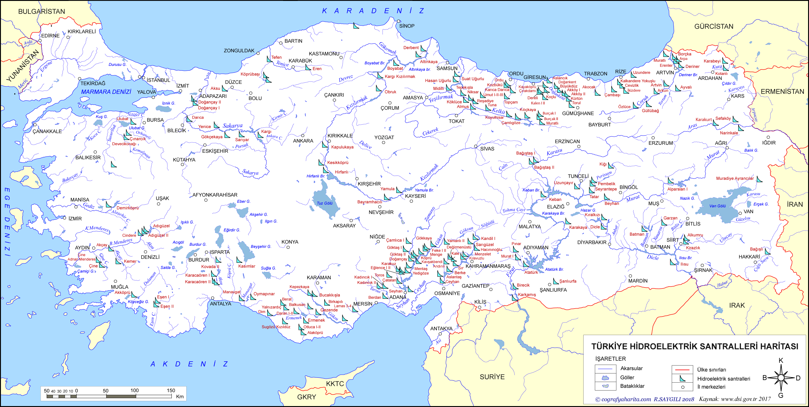
In Turkey, there are 25 river basins and 320 lakes. The total water potential of the country is 112 billion m3. The first hydroelectric plant in Turkey was installed in Tarsus in 1902 (Öztürk & Mutlu Öztürk, 2019). As of 2019, the overall number of dams is 860 and HEPPs is 683, of which 616 were built by the private sector (Saygılı, 2018). From the developmental point of view, dams and hydroelectric plants are presented as vehicles of progress (Altinbilek, 2002). However, some believe that they have negative impacts on the environment and socio-cultural life, including tangible and intangible cultural heritage (Yeşil & İnal, 2019; Thaman, 2020; Eken et al., 2016; Wrong Climate for Big Dams, 2011; Başkan, 2018; IUCN, 2015; The False Promises of Hydropower, 2019).
Cultural heritage affected by dam and hydroelectric plant construction can be analysed under cultural heritage (tangible, intangible) components and in relation to flora and fauna (Öztürk & Mutlu Öztürk, 2019). To start with the environmental side, Key Biodiversity Areas are poorly protected in Turkey, with less than 14% protected (Eken et al., 2016). In a 2016 study, the construction of dams and hydroelectric plants emerged as the number one threat to the biodiversity areas of Turkey (Eken et al., 2016). This study identified irrigation and drainage, tourism development, urban development, roads and infrastructure and mining followed by dams and hydroelectric plants (Eken et al., 2016) as major threats to Key Biodiversity Areas, which have lasting irreversible impacts. Although Turkey does not have a natural heritage site on the World Heritage List, these Key Biodiversity Areas form the most valuable natural resources, where we observe a close geographical match with those properties on the World Heritage List. Due to this reason, we can easily say that dams and hydroelectric plants do change the landscape and therefore play an important role in the challenges that World Heritage properties in Turkey face.
The most emblematic site that is affected by dam construction in Anatolia is the Hasankeyf settlement, which contains traces of 12,000 years of human presence in the region. Civil society, national and international experts have tried extensively to highlight the importance of the site. However, due to the construction on Ilısu Dam in 2006, the historic centre of the city was submerged in 2020. Over the years, through rescue excavations, only a minimal part of this rich cultural heritage could be salvaged (Figs. 24.1 and 24.2). Some examples of the losses in the region include the following: 300 historical mounds were affected, several historical monuments (Zeynel Bey Tomb, fifteenth century, Er-Rızk Mosque, fifteenth century, and Artukid Bath, fourteenth century, among others) in the city centre were relocated, and five villages were moved to a distant place. The waters of the Tigris River have shaped the landscape of Hasankeyf through millions of years of erosion at the cliffs of the valley. Ethnobotanical studies reveal either a dramatic or gradual loss of traditional knowledge and practice in the case of Hasankeyf. The flora of Ilısu (Hasankeyf) and its surroundings embodies 472 taxa belonging to 279 genera and 64 families, of which twenty taxa are threatened by the dam project, as they are endemic to this region (Yesil & Inal, 2019).

Hasankeyf before dam construction. (Note. Photograph by B. Gün, 2017)

Hasankeyf during dam construction. (Note. Photograph by B. Gün, 2018)
Another example is the Yortanlı Dam that affected the Allianoi (second century AD) Roman archaeological site near Bergama. Allianoi is the extraordinary site of a health resort from antiquity, where thermal baths, pools and surgical equipment used in operations were identified in the region along with famous mosaics. Against extensive civil society appeals made to stop the dam construction to save the site, this important archaeological site has been submerged under since 2011. Rescue excavations in the region continued between 1994 and 2006 and managed to dig only 30% of the entire site (Hamamcioglu-Turan et al., 2013).
These examples reveal that dam constructions may have direct and indirect impacts on cultural and natural heritage. The prioritization of energy over the socio-cultural components (including the cultural heritage), such as in Hasankeyf and Yortanlı Dams, have led to irreversible damage and caused the loss of archaeological strata in submerged areas. Translocation of cultural heritage has raised questions regarding the relationship between cultural property and its setting, as well as issues related to the cultural memory of the area. Biological loss in the region is another layer added to the costs of dams to the region. Furthermore, the bond between endemic plants and intangible cultural heritage practices alters the gastronomic practices and rituals of the region.
Additionally, increased humidity due to extensive surface water harms building materials and alters their reaction to climatic conditions. The changing groundwater level is another potential risk for the existing cultural heritage that may cause structural problems due to ground subsidence. Especially considering that water consumption per person has increased dramatically in recent years, the lack of sewage systems and the poor maintenance of existing systems bear significant risks. Change in land use is another factor that severely affects groundwater levels. Unsuitable crop choices and irrigation systems are contributing to this issue. Multiple factors contribute to other hazards, including sinkholes that have been more frequently seen in Anatolia in recent years (Demir & Keskin, 2020). Droughts and extreme climatic events are expected due to the desertification of the region. From October to December 2020, precipitation across the country measured 48% lower than the average for 1981–2010.
5 Conclusions: Learning from the Water Technology of the World Heritage Properties of Turkey
Historical and archaeological evidence shows that direct access to water was not of primary concern for the selection of the sites for World Heritage properties in Anatolia. In the absence of immediate freshwater sources, human creative genius stepped in, harvesting rainwater and transporting it from distant places as water was always scarce and therefore treated with care. In order to overcome these challenges, various inspiring forms of water technology were developed to provide sustenance for the communities. Furthermore, ancient systems diversified water resources, which accommodated all forms of water (springs, rivers, lakes, rainwater, transported water etc.). Ancient communities lived and consumed proportionately and appropriate to environmental givens (certain crop types, building materials and typologies) were preferred above others. To make the most of the existing resources, systems that did not expose large surfaces of water were favoured (cisterns, channels, wells), keeping water underground or undercover. Mechanisms for clean and equal sharing of water were developed. Water was considered sacred, and intangible practices were developed as part of healing and religious purposes. Knowledge of underground water (groundwater, aquifers etc.) was incorporated into design solutions.
Therefore, lessons from traditional water management systems in Anatolia can be key guiding principles for mitigating impacts of climate change and reaching the 2030 Agenda. Specifically, how we use and manage water will affect our ability to achieve Goals 11: Sustainable Cities and Communities, 12: Responsible Consumption and Production, 13: Climate Action and 16: Peace. Since the notion of sustainability relies on a delicate balance between what we take from nature and what we give in return, human society and culture that is bound to water stand in a vulnerable position.
The existing and planned new interventions in the natural flow of rivers in Anatolia clearly puts communities within Turkey and those downstream in an isolated position in their fight against climate- and water-related challenges. Innovative new technologies available to communities can help bridge the gap between actual realities created and developed at the state level and the enhancement of the resilience of communities. Evidence-based new technologies such as meteorological data on droughts, flash floods and extreme weather events are becoming more easily available and could be of great assistance. The existing and future struggle for climate mitigation at the community level can benefit from awareness-raising on traditional knowledge and water technology practices. Developing integrated design-based solutions for water harvesting (from rain, air and seawater), cheap low-power irrigation and smart local use of water locally seem to be the only existing strategies that communities can develop in the absence of governmental commitment at the global level.
References
Al-Muqdadi, S. W. H. (2019). Developing strategy for water conflict management and transformation at Euphrates-Tigris basin. Water, 11(10). https://doi.org/10.3390/w11102037
Altınbilek, D. (2002). The role of dams in development. Water Science and Technology, 45(8), 169–180. https://doi.org/10.1080/07900620220121620
Angelakis, A. N. (2012). Evolution of water supply through the millennia. IWA Publishing. https://doi.org/10.2166/9781780401041
Başkan, S. (2018). Artvin Baraj Rezervuarları Altında Kalan Maddi Tarihi Kültürel Mirasın Değerlendirmesi. ZfWT, 10(1), 199–217.
Berga, L. (2016). The role of hydropower in climate change mitigation and adaptation: A review. Engineering, 2(3), 313–318. https://doi.org/10.1016/J.ENG.2016.03.004
Bildirici, M. (2020). Tarihi Kültürel ve Çevre Değerleri ile Konya Kapaşı Havzasına Su Aktaran Konya-Çumra 2.ve 3. Merhale (ADIM) Sulama Projesi, Devlet Su İşleri Genel Müdürlüğü.
Bixio, A., Bixio, R., & Pascale, A. D. (2020). Underground hydraulic systems and anthropogenic cavities in Cappadocia. In P. Boschiero & L. Latini (Eds.), Güllüdere and Kızılçukur: Rose Valley and Red Valley in Cappadocia. Premio Internazionale Carlo Scarpa per Il Giardino (31st ed.). 2020–2021 Fondazione Benetton Studi Ricerche-Antiga.
Çeçen, K. (1996). The longest Roman water supply line. Istanbul Sınai Kalkınma Bankası.
Clare, L. (2020). Göbekli Tepe, Turkey. A brief summary of research at a new world heritage site (2015–2019). e FORSCHUNGSBERICHTE, 2, 81–88.
Crow, J. (2012). Ruling the waters: Managing the water supply of Constantinople, AD 330–1204. Water History, 4(1), 35–55. https://doi.org/10.1007/s12685-012-0054-y
Çulcuoğlu, G., Erkan, Y. K., & Karakul, Ö. (Eds.). (2013). UNESCO World Heritage in Turkey. Turkish National Comission for UNESCO.
Demir, V., & Keskin, A. Ü. (2020). Water level change of lakes and sinkholes in Central Turkey under anthropogenic effects. Theoretical and Applied Climatology, 142(3–4), 929–943. https://doi.org/10.1007/s00704-020-03347-5
Doğa araştırmacısı iki arkadaş 2 bin 500 yıllık gizli geçidi ortaya çıkardı: Safranbolu tarihinde yeni bir … (2021, February 27). Yeni Şafak. Retrieved October 30, 2021, from https://www.yenisafak.com/hayat/doga-arastirmacisi-iki-arkadas-2-bin-500-yillik-gizli-gecidi-ortaya-cikardi-safranbolu-tarihinde-yeni-bir-sayfa-acilabilir-3601256
Douet, J. (2018). The water industry as World Heritage thematic study. TICCIH.
Editor. (2019, October 7). Safranbolu’nun Gün Yüzü Görmemiş 400 Yıllık Gizli Tünelleri. Nereye. https://nereye.com.tr/safranbolunun-gun-yuzu-gormemis-400-yillik-gizli-tunelleri/
Eken, G., Isfendiyaroğlu, S., Yeniyurt, C., Erkol, I. L., Karataş, A., & Ataol, M. (2016). Identifying key biodiversity areas in Turkey: A multi-taxon approach. International Journal of Biodiversity Science, Ecosystem Services and Management, 12(3), 181–190. https://doi.org/10.1080/21513732.2016.1182949
Graff, S. R., Branting, S., & Marston, J. M. (2019). Production requires water: Material remains of the hydrosocial cycle in an ancient Anatolian city. Economic Anthropology, 6(2), 234–249. https://doi.org/10.1002/sea2.12147
Hamamcıoğlu-Turan, M., Arısoy, Y., Nuhoğlu, A., & Erturan, Y. P. (2013). Protection of archaeological remains in the Yortanli dam reservoir in Turkey. International Journal of Architectural Heritage, 7(6), 653–672. https://doi.org/10.1080/15583058.2012.655404
Harmanşah, Ö. (2018). Geologies of belonging: Political ecology of water in Central Anatolia. In E. Holt (Ed.), Water and power in past societies (pp. 259–279). State University of New York Press.
İlhan, A. (2013). Rivers for life. Review, 3(6), 666–667. https://doi.org/10.1111/an.2004.45.3.22
İlhan, A. (2017). Suya Erişim Hakkından Suyun Akma Hakkına. In A. İlhan, E. Erdoğan, N. Yüce, & Ö. Özbay (Eds.), Türkiye’ de ve Dünyada Su Krizi ve Su Hakkı Mücadeleleri (pp. 29–45) [Brochure] https://www.suhakki.org/docs/kitap_su-krizi-su-hakki-mucadeleleri-web.pdf). Sivil ve Ekolojik Haklar Derneği.
IUCN. (2015). Climate Change and dams threaten natural World Heritage, warns IUCN New report on Impacts of Mae Wong Dam in Thailand underlines dangers. Retrieved October 30, 2021, from https://www.iucn.org/sites/dev/files/import/downloads/cc_and_dams_threaten_natural_world_heritage__warns_iucn.pdf
Jensen-Cormier, C. (2019, November). Watered down: How big hydropower companies adhere to social and environmental policies and best practices. International Rivers. Retrieved October 30, 2021, from https://3waryu2g9363hdvii1ci666p-wpengine.netdna-ssl.com/wp-content/uploads/sites/86/2020/10/watered-down-full-report-english-compressed.pdf
Madani, K. (2014). Water management in Iran: What is causing the looming crisis? Journal of Environmental Studies and Sciences, 4(4), 315–328. https://doi.org/10.1007/s13412-014-0182-z
Öziş, Ü. (1996). Historical water schemes in Turkey. International Journal of Water Resources Development, 12(3), 347–384. https://doi.org/10.1080/07900629650213
Öziş, Ü., Arisoy, Y., & Alkan, A. (2010). Ancient waterworks in Anatolia. In V. Mladenov & Z. Bojkovic (Eds.), Latest trends on cultural heritage and tourism (pp. 63–71). WSEAS.
Öztürk, H. K., & Mutlu Öztürk, H. (2019). Hidrolik Santrallerin Turizm ve Kültürel Mirası Üzerine Etkisi (the impact of hydroelectric power plants on tourism and cultural heritage). Journal of Tourism and Gastronomy Studies, 7(3), 2321–2335. https://doi.org/10.21325/jotags.2019.474
Reyhan, K., & Yazıcı, M. (2020). Su kültürü, tarihsel, toplumsal gelişme sürecinde su ile ilişkili oluşturulan bütün maddi ve manevi değerler ile bu değerlerin oluşturulmasında ve sonraki nesillere iletmede kullanılan bilgi, özgün düşünce, yaşam ve sanat eserlerinin bütünlüğüne işar. Avrasya Uluslararası Araştırmalar Dergisi, 8(23), 45–57.
Rivers without Boundaries International Coalition, Wilderness Society Tasmania, Ohrid SOS, Yayasan HAkA, SOSOrinoco, World Heritage Watch, & International Rivers. (2021). Oral statement on rivers and increasing dam damage (item 7, closing of the item). World Heritage Watch. Retrieved October 30, 2021, from https://world-heritage-watch.org/content/wp-content/uploads/2021/07/WHW-Statement-on-44COM-7Rivers-and-Dam-Damage.pdf
Sanyanga, R., Simon, M., & Hill, C. (2020). Transforming power: A gender guide for organisations campaigning on dams and for rivers. International Rivers. Retrieved October 30, 2021, from https://www.internationalrivers.org/wp-content/uploads/sites/86/2020/09/Gender-Guide-English-single-pages.pdf
Saygılı, R. (2018). Turkiye hidroelektrik santralleri haritası. Cografya Harita. Retrieved October 30, 2021, from http://cografyaharita.com/haritalarim/4eturkiye-2017-hidroelektrik-santralleri-haritasib2.png
Sevimli, Ş., & Uzel, İ. (2003). Water technology and cleanliness on the Hittite B. C. 1700–1200. In Proceedings of the first international exergy, energy and environment symposium, 13–17 July 2003 İzmir Turkey, July (pp. 264–271).
Tanyeli, G., & İkiz, D. (2017). The cultural heritages of water in Turkey. In M. Cotte (Ed.), Cultural heritages of water les patrimoines culturels de l ’ eau (pp. 221–240). ICOMOS.
Thaman, R. M. (2020). The Ilisu dam and its impact on the Mesopotamian marshes of Iraq: Implications for the future directions of international water law. International Water Law, 5(4), 3–92. https://doi.org/10.1163/23529369-12340020
The False Promises of Hydropower. (2019). The false promises of hydropower. https://archive.internationalrivers.org/sites/default/files/attached-files/declaration_iha2019_21x30_english_for_printing.pdf
Voss, K. A., Famiglietti, J. S., Lo, M., De Linage, C., Rodell, M., & Swenson, S. C. (2013). Groundwater depletion in the Middle East from GRACE with implications for transboundary water management in the Tigris-Euphrates-Western Iran region. Water Resources Research, 49(2), 904–914. https://doi.org/10.1002/wrcr.20078
Willems, W. J. H., & Van Schaik, H. P. J. (Eds.). (2015). Water & heritage. Sidestone Press. https://www.ifugao-archaeological-project.org/uploads/6/4/4/7/6447606/acabado_&_martin_2015_-_between_pragmatism_and_cultural_context.pdf
Wittenberg, H., & Schachner, A. (2013). The ponds of Hattuša – Early groundwater management in the Hittite kingdom. Water Science and Technology: Water Supply, 13(3), 692–698. https://doi.org/10.2166/ws.2013.025
World Bank. (2017). Greenhouse gases from reservoirs caused by biogeochemical processes. World Bank. https://doi.org/10.1596/29151
Wrong Climate for Big Dams. (2011, October). International rivers. Retrieved October 30, 2021, from https://www.internationalrivers.org/wp-content/uploads/sites/86/2020/05/intlrivers_wrongclimate_4.pdf
Yeşil, Y., & İnal, I. (2019). Traditional knowledge of wild edible plants in Hasankeyf (Batman Province, Turkey). Acta Societatis Botanicorum Poloniae, 88(3), 1–22. https://doi.org/10.5586/asbp.3633
Author information
Authors and Affiliations
Corresponding author
Editor information
Editors and Affiliations
Rights and permissions
Open Access This chapter is licensed under the terms of the Creative Commons Attribution 4.0 International License (http://creativecommons.org/licenses/by/4.0/), which permits use, sharing, adaptation, distribution and reproduction in any medium or format, as long as you give appropriate credit to the original author(s) and the source, provide a link to the Creative Commons license and indicate if changes were made.
The images or other third party material in this chapter are included in the chapter's Creative Commons license, unless indicated otherwise in a credit line to the material. If material is not included in the chapter's Creative Commons license and your intended use is not permitted by statutory regulation or exceeds the permitted use, you will need to obtain permission directly from the copyright holder.
Copyright information
© 2022 The Author(s)
About this chapter

Cite this chapter
Erkan, Y. (2022). Change in Water Technology in Anatolia: From Use to Energy, Conflicts to Climate Action. In: Albert, MT., Bernecker, R., Cave, C., Prodan, A.C., Ripp, M. (eds) 50 Years World Heritage Convention: Shared Responsibility – Conflict & Reconciliation. Heritage Studies. Springer, Cham. https://doi.org/10.1007/978-3-031-05660-4_24
Download citation
DOI: https://doi.org/10.1007/978-3-031-05660-4_24
Published:
Publisher Name: Springer, Cham
Print ISBN: 978-3-031-05659-8
Online ISBN: 978-3-031-05660-4
eBook Packages: Social SciencesSocial Sciences (R0)