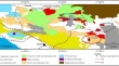
Spatiotemporal Change of Aeolian Desertification Land Distribution in Northern China from 2001 to 2015 Lili FengZhiqing JiaYuling Zhao Research Article 10 July 2018 Pages: 1555 - 1561
A Fast Reprojection Method for MODIS Products with Sinusoidal Projection Jian LiShengbo ChenYufei Wang Research Article 27 June 2018 Pages: 1563 - 1567
Assessment of Land Surface Subsidence Due to Underground Metal Mining Using Integrated Spaceborne Repeat-Pass Differential Interferometric Synthetic Aperture Radar (DInSAR) Technique and Ground Based Observations Md Soyeb AlamDheeraj KumarVijay Upreti Research Article 23 July 2018 Pages: 1569 - 1580
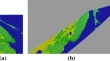
Alteration Mapping for Porphyry Copper Exploration Using ASTER and QuickBird Multispectral Images, Sonajeel Prospect, NW Iran Zahra YazdiAlireza Jafari RadPeyman Afzal Research Article 25 July 2018 Pages: 1581 - 1593
Application of Robust Estimation Method in Study of Relationship Between Lake’s Water Area and Water Level Jie LvJunhuan PengBin Li Research Article 20 July 2018 Pages: 1595 - 1603
Improved Fukunaga–Koontz Transform with Compositional Kernel Combination for Hyperspectral Target Detection Hamidullah Binol Research Article 20 July 2018 Pages: 1605 - 1615
Analysis of Lighting Changes in the Tourist City Edogawa Using Nighttime Light Data Yang CaoJing ZhangPeng Gao Research Article 27 July 2018 Pages: 1617 - 1623
Quantifying Four Decades of Changes in Land Use and Land Cover in India’s Kailash Sacred Landscape: Suggested Option for Priority Based Patch Level Future Forest Conservation G. SinghM. S. SarkarR. S. Rawal Research Article 31 July 2018 Pages: 1625 - 1635
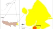
Shoreline Change Analysis at Chilika Lagoon Coast, India Using Digital Shoreline Analysis System Rakesh BaralSubhasis PradhanSujit Kumar Mishra Research Article 31 July 2018 Pages: 1637 - 1644
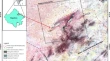
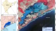
Characterization of Surface Geological Material in Northwest India and Adjoining Areas of Pakistan Using Normalized Difference Water Index, Land Surface Temperature and Silica Index Sanjay Das Research Article 01 August 2018 Pages: 1645 - 1656
Temporal and Spatial Evolution of Land Subsidence Induced by Groundwater Exploitation and Construction in the Eastern Chaoyang District, Beijing, China Yuan SiBeibei ChenMingliang Gao Research Article 31 July 2018 Pages: 1657 - 1665
Analysis of the Seasonal Variation of CO2 Concentration in China Based on GOSAT Satellite Data Lanlan ZhangJinye Zhang Research Article 01 August 2018 Pages: 1667 - 1675
Research on Emergency Rescue of Urban Flood Disaster Based on Wargame Simulation Peng ChenJiquan ZhangYingyue Sun Research Article Open access 06 August 2018 Pages: 1677 - 1687
Variations in the Ice Phenology and Water Level of Ayakekumu Lake, Tibetan Plateau, Derived from MODIS and Satellite Altimetry Data Jun ChenYongFeng WangJiajia Zheng Research Article 31 July 2018 Pages: 1689 - 1699
Yield Forecasting of Spring Maize Using Remote Sensing and Crop Modeling in Faisalabad-Punjab Pakistan Ishfaq AhmadUmer SaeedJasmeet Judge Research Article 07 August 2018 Pages: 1701 - 1711
A Geospatial Approach to Understand the Dynamics of Shifting Cultivation in Champhai District of Mizoram, North-East India Pentile ThongRocky PebamUttam Kumar Sahoo Research Article 07 August 2018 Pages: 1713 - 1723
Species Mapping Using Citizen Science Approach Through IBIN Portal: Use Case in Foothills of Himalaya Priyanka SinghSameer SaranA. Senthil Kumar Research Article 14 August 2018 Pages: 1725 - 1737
Accuracy Assessment of Digital Elevation Model Generated by SAR Stereoscopic Technique Using COSMO-Skymed Data Ritesh AgrawalAnup DasA. S. Rajawat Research Article 16 August 2018 Pages: 1739 - 1747