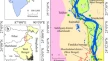
Spatiotemporal dynamics of tuberculosis in East Hararge Zone, Oromiya Region, Ethiopia Aboma Temesgen SebuKasahun Takele GenatiTeshome Kebede Deressa OriginalPaper Open access 27 February 2020 Pages: 623 - 633
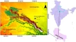
Geospatial understanding of climate parameters within watershed boundaries of India Firoz AhmadLaxmi Goparaju OriginalPaper 27 February 2020 Pages: 635 - 643
Development of open source Web-GIS platform for three-dimensional geologic modeling and visualization Tatsuya NemotoShinji MasumotoFumio Nakada OriginalPaper 28 February 2020 Pages: 645 - 653
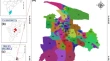
Spatial disparities in the provision of rural health facilities: application of GIS based modelling in rural Birbhum, India Alokananda GhoshBiswaranjan Mistri OriginalPaper 11 March 2020 Pages: 655 - 668
Synergistic use of Sentinel-1 and Sentinel-2 for improved LULC mapping with special reference to bad land class: a case study for Yamuna River floodplain, India Armugha KhanHimanshu GovilRucha Dave OriginalPaper 11 March 2020 Pages: 669 - 681
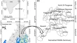
Application of numerical models to simulate the charland area from Rajmahal to Farakka barrage of the Ganga river of eastern India Rajsekhar ChakrabortySwades Pal OriginalPaper 17 March 2020 Pages: 683 - 698
Spatial accessibility analysis of schools using geospatial techniques R. Shanmathi RekhaNisha RadhakrishnanSamson Mathew OriginalPaper 21 March 2020 Pages: 699 - 708
Drainage induced waterlogging problem and its impact on farming system: a study in Gosaba Island, Sundarban, India Soumen GhoshBiswaranjan Mistri OriginalPaper 20 April 2020 Pages: 709 - 721
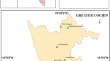
Air quality disturbance zone mapping in greater Cochin region of Kerala state, India using geoinformatics Naveen S. LalJohn Richard ThomasC. T. Aravindakumar OriginalPaper 20 April 2020 Pages: 723 - 734
Performance evaluation of Africa CORDEX regional climate models: case of Kpong irrigation scheme, Ghana James AshaleyGeophrey K. AnornuMaxwell Anim-Gyampo OriginalPaper 08 May 2020 Pages: 735 - 753