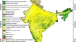
Geo-spatial perspective of vegetation health evaluation and climate change scenario in India Firoz AhmadLaxmi GoparajuAbdul Qayum OriginalPaper 14 February 2019 Pages: 497 - 504
Morphometric analysis and the validity of Hortonian postulations in Anambra drainage basin, Nigeria Chinero Nneka AyoguPhilip Ogbonna Phil-EzeRapheal Iweanya Maduka OriginalPaper 23 February 2019 Pages: 505 - 520
Calculation of area, mapping and vulnerability assessment of a geomorphosite from GPS survey and high resolution Google Earth satellite image: a study in Mama Bhagne Pahar, Dubrajpur C. D. block, Birbhum district, West Bengal Krishanu DattaSomnath Sarkar OriginalPaper 25 February 2019 Pages: 521 - 528
Relationship between groundwater quality and distance to fault using adaptive neuro fuzzy inference system (ANFIS) and geostatistical methods (case study: North of Fars Province) Maryam AghajariMaleeha MozayyanAlireza Amirian Chekan OriginalPaper 26 February 2019 Pages: 529 - 538
Give-And-Take heuristic model to political redistricting problems Myung Jin Kim OriginalPaper 02 March 2019 Pages: 539 - 552
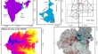
Information value based landslide susceptibility zonation of Dharamshala region, northwestern Himalaya, India Swati SharmaA. K. Mahajan OriginalPaper 06 March 2019 Pages: 553 - 564
Improving the performance of location based spatial textual query processing using distributed strip index M. PriyaR. Kalpana OriginalPaper 09 March 2019 Pages: 565 - 571
Soil survey to support land use/land cover planning in BPS and BPM region in Gangajalghati block, West Bengal, India Sujit DasKrishnendu Gupta OriginalPaper 11 March 2019 Pages: 573 - 586
Change detection in urban landscapes: a tensor factorization approach S. SarithaG. Santhosh Kumar OriginalPaper 16 March 2019 Pages: 587 - 600
Examining the impact of regional land use and land cover changes on temperature: the case of Eastern India Sridhara NayakManabottam Mandal OriginalPaper 19 March 2019 Pages: 601 - 611