Soil organic carbon stock explored by geo-spatial modeling at Sagar Island, India Gouri Sankar BhuniaPravat Kumar ShitRamkrishna Maiti OriginalPaper 12 August 2016 Pages: 503 - 514
Urban heat island explored by co-relationship between land surface temperature vs multiple vegetation indices Narayan KayetKhanindra PathakSatiprasad Sahoo OriginalPaper 23 August 2016 Pages: 515 - 529
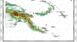
Geospatial modeling of solar radiation to explore solar energy potential in Papua New Guinea Sailesh SamantaDilip Kumar PalBabita Palsamanta OriginalPaper 23 August 2016 Pages: 531 - 544
What drives developing countries to select free open source software for national spatial data infrastructure? Junyoung ChoiMyung-Hwa HwangJaeseong Ahn OriginalPaper 24 August 2016 Pages: 545 - 553
Monitoring negotiation strategy for Forestry Voluntary Carbon Market with North Korea Jung-Sup Um OriginalPaper 29 August 2016 Pages: 555 - 563
Evaluating co-relationship between OCO-2 XCO2 and in situ CO2 measured with portable equipment in Seoul YoungSeok HwangJung-Sup Um OriginalPaper 26 September 2016 Pages: 565 - 575
Development of probability wind speed map based on frequency analysis Insang YuJinho KimSangman Jeong OriginalPaper 04 October 2016 Pages: 577 - 587
4-Dimensional portrayal for volcanic ash diffusion utilizing voxel standardization in case of volcanic ash diffusion models Eunmi ChangYongjae ParkKyeong Park OriginalPaper 14 October 2016 Pages: 589 - 598
Evidence for correlation between land use and PM10 hotspot explored by entropy weight JeongHee HaDongHyeun YoonJuneHwan Koh OriginalPaper 18 October 2016 Pages: 599 - 606
Developing local geoid model to assess accuracy of orthometric heights from GPS-based ellipsoidal heights in Botswana Michael ManisaRabindra Kumar DasLopang Maphale Report 14 October 2016 Pages: 607 - 616