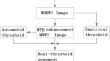
Extracting Road Network by Excluding Identified Backgrounds from High-Resolution Remotely Sensed Imagery Xian-zhong Shi Research Article 10 November 2018 Pages: 367 - 377
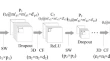
GWDWT-FCM: Change Detection in SAR Images Using Adaptive Discrete Wavelet Transform with Fuzzy C-Mean Clustering Thrisul Kumar JakkaY. Mallikarjuna ReddyB. Prabhakara Rao Research Article 30 November 2018 Pages: 379 - 390
A Novel Method to Extract Narrow Water Using a Top-Hat White Transform Enhancement Technique Bo WuJinmu ZhangYindi Zhao Research Article 29 November 2018 Pages: 391 - 400
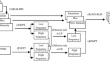
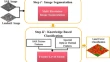
Extracting Urban Impervious Surface from WorldView-2 and Airborne LiDAR Data Using 3D Convolutional Neural Networks Zhongchang SunXiangwei ZhaoCuizhen Wang Research Article Open access 07 December 2018 Pages: 401 - 412
Investigation of Remote Sensing Image Fusion Strategy Applying PCA to Wavelet Packet Analysis Based on IHS Transform Xiaoliang ZhuWenxing Bao Research Article 01 January 2019 Pages: 413 - 425
Mixed Pixel Decomposition Based on Extended Fuzzy Clustering for Single Spectral Value Remote Sensing Images Sumit KaurR. K. BansalLe Hoang Son Research Article 16 January 2019 Pages: 427 - 437
Selection of Landsat8 Image Classification Bands Based on MLC–RFE Huaipeng LiuYongxin Zhang Research Article 01 January 2019 Pages: 439 - 446
Evaluating the Close Range Hyperspectral Data for Feature Identification and Mapping Vinay KumarAnand MohanAsfa Siddiqui Research Article 29 October 2018 Pages: 447 - 454
InSAR Monitoring and Analysis of Ground Deformation Due to Fluid or Gas Injection in Fengcheng Oil Field, Xinjiang, China Jiancun ShiHonglei YangBinbin Zhao Research Article 29 November 2018 Pages: 455 - 466
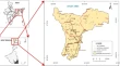
BaDAM Toolbox: A GIS-Based Approach for Automated Drainage Basin Morphometry Chinu JoseJobin ThomasRajesh Reghunath Research Article 29 November 2018 Pages: 467 - 478
Feature-Level Fusion of Landsat 8 Data and SAR Texture Images for Urban Land Cover Classification Fatemeh Tabib MahmoudiAlireza ArabsaeediSeyed Kazem Alavipanah Research Article 29 November 2018 Pages: 479 - 485
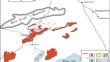
Decadal Pattern of Spatial and Temporal Variability of Nitrate Along the Southwest Bay of Bengal Using Remote Sensing Techniques D. PoornimaR. ShanthiR. K. Sarangi Research Article 01 December 2018 Pages: 487 - 495
Landslide Susceptibility Zonation Mapping: A Case Study from Darjeeling District, Eastern Himalayas, India Amit ChawlaSrinivas PasupuletiRajesh Dwivedi Research Article 01 January 2019 Pages: 497 - 511
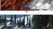
Geo-spatial Modeling for Automated Demarcation of Snow Avalanche Hazard Areas Using Landsat-8 Satellite Images and In Situ Data Dhiraj Kumar SinghVarunendra Dutta MishraArun Kumar Singh Research Article 17 January 2019 Pages: 513 - 526
Accuracy Assessment of Bio-optical Models to Retrieve Backscattering Coefficients in Case 1 Waters of the Bay of Bengal Nikhil Kumar BaranvalP. V. NagamaniS. B. Choudhury Research Article 11 January 2019 Pages: 527 - 535
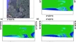
Assessment of Complementary Medium-Resolution Satellite Imageries for Nearshore Bathymetry Estimation Ankita MisraBalaji RamakrishnanRoshanka Ranasinghe Short Note 30 November 2018 Pages: 537 - 540