Adaptive Progressive Band Selection for Dimensionality Reduction in Hyperspectral Images Karim Saheb EttabaaManel Ben Salem Review Article 24 May 2017 Pages: 157 - 167
Object-Based Rule Sets and Its Transferability for Building Extraction from High Resolution Satellite Imagery Reza AttarzadehMehdi Momeni Research Article 23 June 2017 Pages: 169 - 178
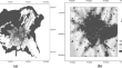
Improved Visualization Using a Fusion Technique Based on KNN Matting of Remotely Sensed Images Ablin RajathuraiHelen Sulochana Chellakkon Research Article 03 July 2017 Pages: 179 - 187
A Directed-Line-Segment-Based Photogrammetry Method to Survey the Tunneling Working Surface of Mine Roadway Yufeng MaoHao LiBiao Yang Research Article 20 June 2017 Pages: 189 - 198
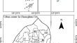
Calibration of a Multi-criteria Evaluation Based Cellular Automata Model for Indian Cities Having Varied Growth Patterns Sandeep Maithani Research Article 29 May 2017 Pages: 199 - 210
Surface Reflectance Climate Data Records (CDRs) is a Reliable Landsat ETM+ Source to Study Chlorophyll Content in Pecan Orchards Yahia OthmanCaiti SteeleRolston St. Hilaire Research Article 20 June 2017 Pages: 211 - 218
An Improved Dimidiated Pixel Model for Vegetation Fraction in the Yarlung Zangbo River Basin of Qinghai-Tibet Plateau Bing GuoFang HanLin Jiang Research Article 20 June 2017 Pages: 219 - 231
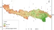
Landslide Mapping and Assessment by Integrating Landsat-8, PALSAR-2 and GIS Techniques: A Case Study from Kelantan State, Peninsular Malaysia Mazlan HashimSyarifuddin MisbariAmin Beiranvand Pour Research Article 31 May 2017 Pages: 233 - 248
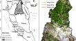
Gondwana-Derived Terranes Structural Mapping Using PALSAR Remote Sensing Data Amin Beiranvand PourMazlan HashimYongcheol Park Research Article 30 May 2017 Pages: 249 - 262
GIS Based Urban Area Spatiotemporal Change Evaluation Using Landsat and Night Time Temporal Satellite Data Emre YücerArzu Erener Research Article 06 June 2017 Pages: 263 - 273
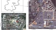
Establishment of an Improved Floor Area Ratio with High-Resolution Satellite Imagery Guangyao DuanHuili GongBeibei Chen Research Article 27 May 2017 Pages: 275 - 286
Evaluating environmental equities of urban forest in terms of cooling services using ETM+ and Google data Ze TangHaifeng ZhengXingyuan He Research Article 03 July 2017 Pages: 287 - 296
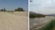
Assessment and Management Flash Flood in Najran Wady Using GIS and Remote Sensing Ismail Elkhrachy Research Article 23 May 2017 Pages: 297 - 308
Seasonal and inter-annual variability of atmosphere CO2 based on NOAA Carbon Tracker analysis and satellite observations M. KrishnapriyaA. Bhuvana ChandraV. K. Dadhwal Research Article 20 June 2017 Pages: 309 - 320
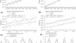
Comparison of Vegetation Indices from Two Ground Based Sensors S. PradhanV. K. SehgalS. L. Jat Short Note 07 June 2017 Pages: 321 - 326