Feature Extraction of Laser Scan Data Based on Geometric Properties Ismail Elkhrachy Research Article 01 April 2016 Pages: 1 - 10
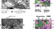
Band Selection and Dimension Estimation for Hyperspectral Imagery—a New Approach Based on Invasive Weed Optimization Parham PahlavaniMahdi HasanlouSiamak Talebi Nahr Research Article 04 April 2016 Pages: 11 - 23
Comparison of Pixel and Object Oriented Based Classification of Hyperspectral Pansharpened Images R. ZoleikaniM. J. Valadan ZoejM. Mokhtarzadeh Research Article 04 April 2016 Pages: 25 - 33
Determining the Deformation Monitorable Indicator of Point Cloud Using Error Ellipsoid Wei XuanXianghong HuaXiaoxing He Research Article 15 April 2016 Pages: 35 - 43
Modified Dual Winner Takes All Approach for Tri-Stereo Image Matching Using Disparity Space Images Raghavendra Hemant BhaleraoShirish S. GedamKrishna Mohan Buddhiraju Research Article 03 May 2016 Pages: 45 - 54
SIFT-FANN: An efficient framework for spatio-spectral fusion of satellite images Kunal Kumar RaiAparna RaiRamesh K.N Research Article 04 May 2016 Pages: 55 - 65
Identification of Artificial Recharge Sites for Noyyal River Basin Using GIS and Remote Sensing A. Geetha SelvaraniG. MaheswaranK. Elangovan Research Article 15 April 2016 Pages: 67 - 77
Remote Sensing and GIS Based Analysis of Geomorphic Evidences and Morphometry of Active Faults in Kachchh Area Eirin KarSuman Sourav BaralSusanta Borgohain Research Article 05 May 2016 Pages: 79 - 88
Snow Depth Inversion Using the Localized HUT Model Based on FY-3B MWRI Data in the Farmland of Heilongjiang Province, China Lili WuXiaofeng LiXingming Zheng Research Article 02 April 2016 Pages: 89 - 100
Application of Remotely-Sensed Data to Estimate a Water Budget for Data-Scarce Endorheic Basins: A Case Study of Lake Urmia basin, Iran MohammadHossein BagheriSaeid MoridSaleh Arshad Research Article 04 May 2016 Pages: 101 - 112
Generation and Validation of two Day Composite Wind Fields from Oceansat-2 Scatterometer Tata V. S. Udaya BhaskarChiranjivi JayaramDebadatta Swain Research Article 15 March 2016 Pages: 113 - 122
Extracting of six Deformation Parameters Using Improved ICP Matching Based on Terrestrial Laser Scanning Data Xijiang ChenGuang ZhangWei Xuan Short Note 05 April 2016 Pages: 123 - 130
Description of Salient Features Combined with Local Self-Similarity for SAR Image Registration Lijuan YangZheng TianJinhuan Wen Short Note 05 May 2016 Pages: 131 - 138
Camouflage Detection Using MWIR Hyperspectral Images Vinay KumarJ. K. Ghosh Short Note 14 March 2016 Pages: 139 - 145
Potential CO2 Emission Due to Loss of Above Ground Biomass from the Indian Sundarban Mangroves During the Last Four Decades Anirban AkhandAnirban MukhopadhyayK. H. Rao Short Note 04 April 2016 Pages: 147 - 154
A Research on the Monitoring of Coastal Land use with Aerial Photographs in the Example of Kadırga bay (Çanakkale) Tülay CengizMetin Kalyoncu Short Note 26 April 2016 Pages: 155 - 161
Monitoring of deforestation and land use changes (1925–2012) in Idukki district, Kerala, India using remote sensing and GIS Reshma M. RamachandranC. Sudhakar Reddy Short Note 04 May 2016 Pages: 163 - 170
Spectral Characteristics of Weathered Oil Films on Water Surface and Selection of Potential Sensitive Bands in Hyper-Spectral Images Bingxin LiuYing LiLiang Han Short Note 15 March 2016 Pages: 171 - 177
The Application of GF-1 Imagery to Detect Ships on the Yangtze River Bingxin LiuYing LiLiang Han Short Note 02 April 2016 Pages: 179 - 183
June 19 2015 Rainfall Event Over Mumbai: Some Observational Analysis Sudipta SarkarRamesh P. Singh Short Note 04 April 2016 Pages: 185 - 192
Erratum to: A Comparative Evaluation of Denoising of Remotely Sensed Images Using Wavelet, Curvelet and Contourlet Transforms Rizwan Ahmed AnsariKrishna Mohan Buddhiraju Erratum 02 April 2016 Pages: 193 - 193