Ann Based Robust LULC Classification Technique Using Spectral, Texture and Elevation Data R. Suresh KumarC. MenakaM. E. J. Cutler Research Article 21 November 2012 Pages: 477 - 486
Cartosat-1 derived DEM (CartoDEM) towards Parameter Estimation of Microwatersheds and Comparison with ALTM DEM Rajashree Vinod BothaleA. K. JoshiY. V. N. Krishnamurthy Research Article 08 January 2013 Pages: 487 - 495
Evaluation and Comparison of Multi Resolution DEM Derived Through Cartosat-1 Stereo Pair – A Case Study of Damanganga Basin Rajashree Vinod BothaleBhartendu Pandey Research Article 21 November 2012 Pages: 497 - 507
Automatic Determination of Number of Homogenous Regions in SAR Images Utilizing Splitting and Merging Based on a Reversible Jump MCMC Algorithm Ghasem AskariAigong XuSeyed Kazem Alavipanah Research Article 30 April 2013 Pages: 509 - 521
Satellite Data Classification Using Open Source Support S. BiswalA. GhoshP. K. Joshi Research Article 30 April 2013 Pages: 523 - 530
Optical Detectors for Integration into a Low Cost Radiometric Device for In-Water Applications: A Feasibility Study Arshath RamkilowanNaven ChettyDerek Griffith Research Article 28 April 2013 Pages: 531 - 538
Exploitation of TerraSAR-X Data for Land use/Land Cover Analysis Using Object-Oriented Classification Approach in the African Sahel Area, Sudan Khalid BiroBiswajeet PradhanManfred Buchroithner Research Article 24 November 2012 Pages: 539 - 553
Vegetation Dynamics from Denoised NDVI Using Empirical Mode Decomposition Rahul VermaSubashisa Dutta Research Article 21 November 2012 Pages: 555 - 566
Tree Diversity Detection with Mid-Resolution Images and Environmental Data in a Neural Network Mohammad Redowan Research Article 15 January 2013 Pages: 567 - 576
Investigating the Promotion Possibility of No-Hunting Areas to the Protected Areas- a Case Study Seyed Ali JoziMaryam Sohrabi BalsiniArman Jamshidi Research Article 13 January 2013 Pages: 577 - 585
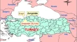
Monitoring Spatial and Temporal Land Use/Cover Changes; a Case Study in Western Black Sea Region of Turkey M. AlkanM. OrucK. Jacobsen Research Article 06 January 2013 Pages: 587 - 596
Deducing Rice Crop Dynamics and Cultural Types of Bangladesh Using Geospatial Techniques Revati MoreK. R. Manjunath Research Article 03 January 2013 Pages: 597 - 607
Geospatial Approach in Assessing Agro-Climatic Suitability of Soybean in Rainfed Agro-Ecosystem Suresh KumarN. R. PatelV. K. Dadhwal Research Article 05 January 2013 Pages: 609 - 618
Identification of Water Conservation Sites in a Watershed (WRJ-2) of Nagpur District, Maharashtra using Geographical Information System (GIS) Technique Abhay M. VaradeY. D. KharePriti Raut Research Article 01 November 2012 Pages: 619 - 630
Automatic Road Extraction from High Resolution Satellite Image using Adaptive Global Thresholding and Morphological Operations Pankaj Pratap SinghR. D. Garg Research Article 21 November 2012 Pages: 631 - 640
Monitoring Urban Landscape Dynamics Over Delhi (India) Using Remote Sensing (1998–2011) Inputs Richa SharmaP. K. Joshi Research Article 22 November 2012 Pages: 641 - 650
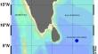
Understanding the Spatial Variability of Chlorophyll a and Total Suspended Matter Distribution Along the Southwest Bay of Bengal Using In-Situ and OCM-2 & MODIS-Aqua Measurements D. PoornimaR. ShanthiA. K. Shukla Research Article 05 January 2013 Pages: 651 - 662
Total Suspended Sediments Mapping by Using ALOS Imagery Over the Coastal Waters of Langkawi Island, Malaysia M. Moussavi AlashlooHwee-San LimSahabeh Safarpour Research Article 16 January 2013 Pages: 663 - 673
Assessment of Coastal Erosion Vulnerability around Midnapur-Balasore Coast, Eastern India using Integrated Remote Sensing and GIS Techniques Adarsa JanaAmit K. Bhattacharya Research Article 13 January 2013 Pages: 675 - 686
Mumbai 2005, Bihar 2008 Flood Reflected in Mass Changes Seen by GRACE Satellites Bramha dutt VishwakarmaKamal JainBalaji Devaraju Research Article 13 January 2013 Pages: 687 - 695
Remote Sensing and GIS Based Landslide Susceptibility Assessment using Binary Logistic Regression Model: A Case Study in the Ganeshganga Watershed, Himalayas S. KunduA. K. SahaC. C. Pant Research Article 13 January 2013 Pages: 697 - 709
Utilizing the Potential of World View −2 for Discriminating Urban and Vegetation Features Using Object Based Classification Techniques Minakshi KumarP. S. Roy Short Note 05 January 2013 Pages: 711 - 717
Road Extraction Using Topological Derivative and Mathematical Morphology P. N. AnilS. Natarajan Short Notes 04 January 2013 Pages: 719 - 724
In Situ Time Series Estimation of Downwelling Diffuse Attenuation Coefficient at Southern Bay of Bengal P. Muhamed AshrafS. S. ShajuB. Meenakumari SHORT NOTE 27 November 2012 Pages: 725 - 730
Reclamative grouping of ravines using Cartosat-1 PAN stereo data Sreenivas KandrikaR. S. Dwivedi Short Note 06 January 2013 Pages: 731 - 737