Spectral modeling based on ground measurements for mine tailing mapping with Landsat ETM+ imagery Nouha MeznedSâadi AbdeljaouadMohamed Rached Boussema Original Paper 10 December 2011 Pages: 1 - 10
Influence of fitting models and point density sample in the detection of deformations of structures using terrestrial laser scanning Sebastian Fuentes SantibanezDaniel Rodrigues dos SantosPedro Luis Faggion Original Paper 17 December 2011 Pages: 11 - 19
Mapping spatial distribution of pollutants in groundwater of a tropical area of India using remote sensing and GIS Prashant K. SrivastavaManika GuptaSaumitra Mukherjee Original Paper 24 December 2011 Pages: 21 - 32
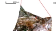
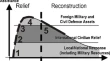
GIS and geomatics for disaster management and emergency relief: a proactive response to natural hazards M. GiardinoL. PerottiG. Perrone Original Paper 06 January 2012 Pages: 33 - 46
A selective combined classification algorithm for mapping alterations on ASTER data Majid M. OskoueiWolfgang Busch Original Paper 26 January 2012 Pages: 47 - 54
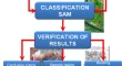
Method validation for the identification of asbestos–cement roofing Lorenza FiumiAntonella CampopianoDeborah Ramires Original Paper 31 January 2012 Pages: 55 - 64