A proposal to include conformal harmonic polynomials in GIS software Sebastian Orihuela Original Paper 02 May 2019 Pages: 331 - 338
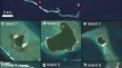
Resolution and scale controls on the accuracy of atoll island shorelines interpreted from satellite imagery Andrew HoldawayMurray Ford Original Paper 10 May 2019 Pages: 339 - 352
Innovative techniques of photogrammetry for 3D modeling Vincenzo BarrileAlice PozzoliAntonino Fotia Original Paper 22 May 2019 Pages: 353 - 369
Dimension reduction of multi-temporal elevation data George Miliaresis Original Paper 03 June 2019 Pages: 371 - 379
On cleaning strategies for WiFi positioning to monitor dynamic crowds Ciro GioiaFrancesco SermiMichele Vespe Original Paper Open access 07 June 2019 Pages: 381 - 399
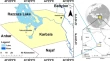
Identification of archeological sites threatened with obliteration using space-borne and ground penetrating radars data in site of Tulul al-Ukhaidir, Iraq Zaidoon Taha AbdulrazzaqJassim Muhammad ThabitAmmar Jasim Al-Khafaji Original Paper 08 June 2019 Pages: 401 - 412
An indoor navigation model and its network extraction Filippo MortariEliseo ClementiniLiu Liu Original Paper 17 June 2019 Pages: 413 - 427
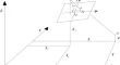
Position determination of encoded and uncoded targets on the large hadron collider at CERN S. LapardhajaE. Lambrou Original Paper 12 July 2019 Pages: 429 - 437