A multi-image super-resolution algorithm applied to thermal imagery Emanuele MandaniciLuca TavasciStefano Gandolfi Original Paper Open access 01 February 2019 Pages: 215 - 228
Image treatment method and spatial analysis of Anna magmatic ring complex (Eglab massif, the Reguibat Rise, South-West Algeria) Ibrahim ZeroualMohammed TabeliounaFatima Zohra Allami Original Paper 02 February 2019 Pages: 229 - 241
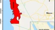
Remote sensing analysis for surface urban heat island detection over Jeddah, Saudi Arabia Yehia H. Miky Original Paper 14 February 2019 Pages: 243 - 258
Exploring the dynamics of urban sprawl using geo-spatial indices: a study of English Bazar Urban Agglomeration, West Bengal Ipsita DuttaArijit Das Original Paper 12 March 2019 Pages: 259 - 276
Exploring the synergy between Landsat and ASAR towards improving thematic mapping accuracy of optical EO data Alexander CassGeorge P. PetropoulosPrashant K. Srivastava Original Paper 13 April 2019 Pages: 277 - 288
GIS-based spatial multi-criteria approach for characterization and prioritization of micro-watersheds: a case study of semi-arid watershed, South India K. BalasubramaniM. GomathiK. Kumaraswamy Original Paper 25 April 2019 Pages: 289 - 307
Free and open-source GIS technologies for the management of woody biomass Michele MangiameliGiuseppe MussumeciFederico G. A. Vagliasindi Original Paper 27 April 2019 Pages: 309 - 315
GIS, remote sensing and MCE approach for identifying groundwater prospective zones in mountainous region of PNG Nebare PoiSailesh Samanta Original Paper 01 May 2019 Pages: 317 - 330