Quality of altimetric surveys in sugarcane agricultural lands performed with GNSS RTK receiver mounted on an all-terrain vehicle Max Well de Oliveira RabeloNori Paulo GriebelerNilton Ricetti Xavier Nazareno Original Paper 29 October 2018 Pages: 111 - 119
Spatiotemporal analysis of urban expansion using GIS and remote sensing in Jigjiga town of Ethiopia Isse BarowMolla MegentaTebarek Megento Original Paper 30 October 2018 Pages: 121 - 127
Landslide susceptibility mapping of Darjeeling Himalaya, India using index of entropy (IOE) model Subrata MondalSujit Mandal Original Paper 23 November 2018 Pages: 129 - 146
Flood hazard mapping under a climate change scenario in a Ribb catchment of Blue Nile River basin, Ethiopia Muluken Abera RobiAdane AbebeSantosh Murlidhar Pingale Original Paper 05 December 2018 Pages: 147 - 160
Measurement and correlation of displacements on the Severn Suspension Bridge using GPS Gethin Wyn RobertsXu TangChristopher J. Brown Original Paper 17 December 2018 Pages: 161 - 176
The use of geomatics techniques to evaluate crop water requirement in Mujib Basin Samih B. Al Rawashdeh Original Paper 18 December 2018 Pages: 177 - 185
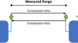
Range validation of UWB and Wi-Fi for integrated indoor positioning Guenther RetscherVassilis GikasAllison Kealy Original Paper Open access 15 January 2019 Pages: 187 - 195
A geospatial analysis of the influence of landscape and climate on the location of Greek vernacular settlements using GIS Aristotelis Vartholomaios Original Paper 31 January 2019 Pages: 197 - 213