Hyperspectral and multispectral image fusion techniques for high resolution applications: a review Dioline SaraAjay Kumar MandavaAnitha Jude Review Article 17 May 2021 Pages: 1685 - 1705
A review of models for water level forecasting based on machine learning Wei Joe WeeNur’atiah Binti ZainiAhmed El-Shafie Review Article 20 July 2021 Pages: 1707 - 1728
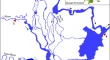
Research advances in remote sensing monitoring of sea ice in the Bohai sea Shuai YuanChengyu LiuYujin Zhang Review Article 23 August 2021 Pages: 1729 - 1743
Urban classification using preserved information of high dimensional textural features of Sentinel-1 images in Tabriz, Iran Mohammad GhasemiSadra KarimzadehBakhtiar Feizizadeh Research Article 17 April 2021 Pages: 1745 - 1762
Change detection in remote sensing images based on manifold regularized joint non-negative matrix factorization Weidong YanXinxin LiuRui Zhao Research Article 26 April 2021 Pages: 1763 - 1776
An efficient correlation based adaptive LASSO regression method for air quality index prediction Jasleen Kaur SethiMamta Mittal Research Article 29 April 2021 Pages: 1777 - 1786
Ensemble data-driven rainfall-runoff modeling using multi-source satellite and gauge rainfall data input fusion Vahid NouraniHüseyin GökçekuşTagesse Gichamo Research Article 29 April 2021 Pages: 1787 - 1808
Applicability evaluation and improvement of different snow evaporation calculation methods in the Great Xing’an mountains Youwei LinTijiu CaiXueqing Cui Research Article 15 May 2021 Pages: 1809 - 1820
Spatio-temporal evolution and influencing factors of land use in Tibetan region: 1995–2025 Li chenQing wang Research Article 25 May 2021 Pages: 1821 - 1832
Dealing with soil organic carbon modeling: some insights from an agro-ecosystem in Northeast Iran Ali KeshavarziHenry Oppong TuffourVinod Kumar Research Article 26 May 2021 Pages: 1833 - 1845
An efficient content-based satellite image retrieval system for big data utilizing threshold based checking method Sunitha TSivarani T.S Research Article 24 June 2021 Pages: 1847 - 1859
Using hybrid artificial intelligence approach based on a neuro-fuzzy system and evolutionary algorithms for modeling landslide susceptibility in East Azerbaijan Province, Iran Solmaz AbdollahizadMohammad Ali BalafarKarim Samadzamini Research Article 01 July 2021 Pages: 1861 - 1882
Correction to: Using hybrid artificial intelligence approach based on a neuro‑fuzzy system and evolutionary algorithms for modeling landslide susceptibility in East Azerbaijan Province, Iran Solmaz AbdollahizadMohammad Ali BalafarKarim Samadzamini Correction 14 September 2021 Pages: 1883 - 1883
Mars weather data analysis using machine learning techniques Ishaani PriyadarshiniVikram Puri Research Article 04 July 2021 Pages: 1885 - 1898
What are the dominant influencing factors on the soil erosion evolution process in the Yellow River Basin? Hongwei WuBing GuoCuixia Wei Research Article 05 July 2021 Pages: 1899 - 1915
Correction to: What are the dominant influencing factors on the soil erosion evolution process in the Yellow River Basin? Hongwei WuBing GuoCuixia Wei Correction 17 September 2021 Pages: 1917 - 1917
Drilling vibrations diagnostic through drilling data analyses and visualization in real time application Farouk Said BoukrederaAhmed HadjadjMohamed Riad Youcefi Research Article 07 July 2021 Pages: 1919 - 1936
A deep convolutional neural network for rock fracture image segmentation Hoon ByunJineon KimJae-Joon Song Research Article 08 July 2021 Pages: 1937 - 1951
Measuring the similarity of building patterns using Graph Fourier transform Zhanlong ChenXiaochuan MaZhong Xie Research Article 08 July 2021 Pages: 1953 - 1971
Determining the weights of influencing factors of construction lands with a neural network algorithm: a case study based on Ya’an City Lei GaoYazhou ZhouXiaofan Zhu Research Article 09 July 2021 Pages: 1973 - 1985
Advanced water level prediction for a large-scale river–lake system using hybrid soft computing approach: a case study in Dongting Lake, China Bin DengSai Hin LaiRen Jie Chin Research Article 12 July 2021 Pages: 1987 - 2001
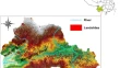
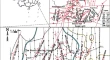
Distribution and origin of anomalously high permeability zones in Weizhou formation, Weizhou 12-X oilfield, Weixinan Sag, China Guosong ChenYuanlin MengLihua Xiao Research Article Open access 13 July 2021 Pages: 2003 - 2015
Investigating capability of open archive multispectral and SAR datasets for Wheat crop monitoring and acreage estimation studies Manjari UpretiDeepak Kumar Research Article 31 July 2021 Pages: 2017 - 2035
Integrated image defogging network based on improved atmospheric scattering model and attention feature fusion Shengmin HeZhixiang ChenMeiya Wang Research Article 03 August 2021 Pages: 2037 - 2048
The copper grade estimation of porphyry deposits using machine learning algorithms and Henry gas solubility optimization Maliheh AbbaszadehMohammad EhteramAhmed Elshafie Research Article 04 August 2021 Pages: 2049 - 2075
A study on the analysis of heavy metal concentration using spectral mixture modelling approach and regression in Tirupur, India G. Wiselin Jiji Research Article 06 August 2021 Pages: 2077 - 2086
A wavelet-outlier robust extreme learning machine for rainfall forecasting in Ardabil City, Iran Farzad EsmaeiliSaeid ShabanlouMohsen Saadat Research Article 11 August 2021 Pages: 2087 - 2100
Texture mapping of geological modeling based on parameterization Lin LiuJianfeng HeZhibo Wang Research Article 13 August 2021 Pages: 2101 - 2112
Predicting soil organic carbon by integrating Landsat 8 OLI, GIS and data mining techniques in semi-arid region Mohammad AkbariIman GoudarziIman Bakhshayeshi Research Article 14 August 2021 Pages: 2113 - 2122
Spatiotemporal variability of trend in extreme precipitations using fuzzy clustering over Northwest Iran Marziyeh EsmaeilpourAhmad Reza GhasemiShahnaz Rashedi Research Article 14 August 2021 Pages: 2123 - 2132
Spatial analysis of factors influencing land subsidence using the OLS Model (Case Study: Fahlian Aquifer) Abouzar NasiriNajmeh ShafieeRahman Zandi Research Article 20 August 2021 Pages: 2133 - 2144
Remote sensing statistical inference: basic theory and forward simulation of water–air statistical radiative transfer Weining Zhu Research Article 24 August 2021 Pages: 2145 - 2159
Semantic segmentation of high-resolution satellite images using deep learning Kuldeep ChaurasiaRijul NandyMeghana Ahire Research Article 24 August 2021 Pages: 2161 - 2170
Unmanned aerial vehicle (UAV) remote sensing estimation of wheat chlorophyll in subsidence area of coal mine with high phreatic level Xiao HuBeibei NiuXiangyu Min Research Article 26 August 2021 Pages: 2171 - 2181
Application of fuzzy logic and neural networks for porosity analysis using well log data: an example from the Chanda Oil Field, Northwest Pakistan Natasha KhanKhaista Rehman Research Article 28 August 2021 Pages: 2183 - 2199
Correction to: Application of fuzzy logic and neural networks for porosity analysis using well log data: an example from the Chanda Oil Field, Northwest Pakistan Natasha KhanKhaista Rehman Correction 22 September 2021 Pages: 2201 - 2202
Optimizing reservoir operation to avoid downstream physical habitat loss using coupled ANFIS- metaheuristic model Mahdi SedighkiaBithin DattaAsghar Abdoli Research Article 01 September 2021 Pages: 2203 - 2220
Python parallel processing for hyperspectral image simulation: based on distance functions Veerendra Satya Sylesh PeddintiVenkata Ravibabu MandlaSuresh Kancherla Research Article 03 September 2021 Pages: 2221 - 2229
A comparative analysis of different pixel and object-based classification algorithms using multi-source high spatial resolution satellite data for LULC mapping Akanksha BalhaJaved MallickChander Kumar Singh Research Article 03 September 2021 Pages: 2231 - 2247
Commutative encryption and watermarking based on SVD for secure GIS vector data Na RenMing ZhaoYazhou Zhao Research Article 07 September 2021 Pages: 2249 - 2263
Validation of double averaged velocity method in a variable width river Ehsan Shahiri TabarestaniHossein AfzalimehrQuoc Bao Pham Research Article 10 September 2021 Pages: 2265 - 2278
Prediction of channel sinuosity in perennial rivers using Bayesian Mutual Information theory and support vector regression coupled with meta-heuristic algorithms Masoud HaghbinAhmad SharafatiDavide Motta Research Article 10 September 2021 Pages: 2279 - 2292
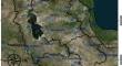
The seasonal and spatial distribution of hydrochemical characteristics of groundwater and its controlling factors in the eastern Loess Plateau Congjian SunWei ChenYanjun Shen Research Article 17 September 2021 Pages: 2293 - 2308
Identification of specific wavelength regions for separating optically similar signals of coral reef benthic compositions Kandasami NimalanMuniappan ThanikachalamTune Usha Research Article 17 September 2021 Pages: 2309 - 2315
Prediction of urban water accumulation points and water accumulation process based on machine learning Hongfa WangYajuan ZhaoHuiliang Wang Research Article 18 September 2021 Pages: 2317 - 2328
Correction to: Prediction of urban water accumulation points and water accumulation process based on machine learning Hongfa WangYajuan ZhaoHuiliang Wang Correction 23 October 2021 Pages: 2329 - 2329
BDS precise point positioning ambiguity resolution with high rate data and its application to seismic displacement and marine surveying Zongqiu XuNannan YangMeng Gao Research Article 18 September 2021 Pages: 2331 - 2346
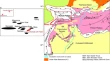
Susceptibility assessment of small, shallow and clustered landslide Xuemei LiuPengcheng SuTaiqiang Yang Research Article 23 October 2021 Pages: 2347 - 2356
Urban structure type mapping method using spatial metrics and remote sensing imagery classification Luccas Z. MaselliRogério G. Negri Methodology Article 12 June 2021 Pages: 2357 - 2372
Risk Assessment of water inrush under an unconsolidated, confined aquifer: the application of GIS and information value model in the Qidong Coal Mine, China Zhihong PengLuwang ChenYifei Chen Methodology Article 10 September 2021 Pages: 2373 - 2386