Impact of elevation mask on multi-GNSS precise point positioning performance Yi bin WuYanyan LiuHong bin Ge Review Article 12 May 2021 Pages: 1111 - 1120
Clustering activity at Mt Etna based on volcanic tremor: A case study Giuseppe Nunnari Research Article Open access 20 April 2021 Pages: 1121 - 1143
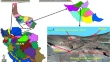
Combining morphological filtering, anisotropic diffusion and block-based data replication for automatically detecting and recovering unscanned gaps in remote sensing images Dayara BassoMarilaine ColnagoWallace Casaca Research Article 11 April 2021 Pages: 1145 - 1158
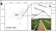
Study on directional reflectivity characteristics analysis of mixed pixels using multi-angle spectral measurements Haonan ZhangXingping WenJunlong Xu Research Article 20 May 2021 Pages: 1159 - 1172
Enhancing hyperspectral image compression using learning-based super-resolution technique Mohand OuahiouneSoltane AmeurMourad Lahdir Research Article 03 June 2021 Pages: 1173 - 1183
On the unit root nonstationary behavior of daily self-potential (SP) time series with infinite variance noise: an example from Urla, Izmir-Turkey Petek Sindirgi Research Article 18 May 2021 Pages: 1185 - 1196
High-resolution time-frequency hilbert transform using sparsity-aware weighting function Mohsen Kazemnia KhakhkiPeyman Poor MoghaddamWebe J. Mansur Research Article 11 June 2021 Pages: 1197 - 1212
Suitable site selection for offshore wind farms in Turkey’s seas: GIS-MCDM based approach Mustafa Serdar GençFatih KaripoğluŞükrü Taner Azgın Research Article 31 May 2021 Pages: 1213 - 1225
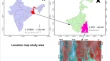
Spatial modeling and susceptibility zonation of landslides using random forest, naïve bayes and K-nearest neighbor in a complicated terrain Sherif Ahmed Abu El-MagdSk Ajim AliQuoc Bao Pham Research Article 24 June 2021 Pages: 1227 - 1243
Retrieval and analysis of land surface temperature in permafrost regions in Northeast China based on AMSR2 data Han YinMiao LiShuying Zang Research Article 22 July 2021 Pages: 1245 - 1260
Enhanced statistical tests under indeterminacy with application to earth speed data Muhammad Aslam Research Article 01 July 2021 Pages: 1261 - 1267
Groundwater level as an input to monthly predicting of water level using various machine learning algorithms Michelle SapitangWanie M. RidwanAhmed El-Shafie Research Article 05 July 2021 Pages: 1269 - 1283
Selection of optimal bands of AVIRIS – NG by evaluating NDVI with Sentinel-2 Veerendra Satya Sylesh PeddintiVenkata Ravibabu MandlaSuresh Kancharla Research Article 08 July 2021 Pages: 1285 - 1302
Multi-GNSS (GPS/Galileo) single-frequency precise point positioning: a case study over Victoria Fereydoun Nobakht-ErsiAbdolreza Safari Research Article 09 July 2021 Pages: 1303 - 1313
Shoreline changes over last five decades and predictions for 2030 and 2040: a case study from Cuddalore, southeast coast of India Logesh NatarajanNagulan SivagnanamPriyadarsi Debajyoti Roy Research Article 10 July 2021 Pages: 1315 - 1325
Unsupervised automatic classification of all-sky auroral images using deep clustering technology Qiuju YangChang LiuJimin Liang Research Article 31 May 2021 Pages: 1327 - 1337
Prediction of the earthquake magnitude by time series methods along the East Anatolian Fault, Turkey Hatice Oncel CekimSenem TekinGamze Özel Research Article 15 June 2021 Pages: 1339 - 1348
Spatial prediction of loose aquifer water abundance mapping based on a hybrid statistical learning approach Qi ZhangZaiyong Wang Research Article 06 July 2021 Pages: 1349 - 1365
Investigation and zoning of geo-environmental risk around the western edge of Khareshk village's oil transmission line, Iran Amin Mohebbi TafreshiGhazaleh Mohebbi Tafreshi Research Article 24 July 2021 Pages: 1367 - 1381
Urban correction of global DEMs using building density for Nairobi, Kenya Victor OlajubuMark A. TriggJoe Mulligan Research Article Open access 30 June 2021 Pages: 1383 - 1398
An integration of adaptive neuro-fuzzy inference system and firefly algorithm for scour estimation near bridge piers Afshin KohansarbazAshkan KohansarbazSaeid Shabanlou Research Article 03 July 2021 Pages: 1399 - 1411
Reliability extracted from the history file as an intrinsic indicator for assessing the quality of OpenStreetMap Najmeh TeimooryRahim Ali AbbaspourAlireza Chehreghan Research Article 29 July 2021 Pages: 1413 - 1432
Assessment of automatic extraction of surface water dynamism using multi-temporal satellite data Gouri Sankar Bhunia Research Article 06 May 2021 Pages: 1433 - 1446
Semi-automated method for the mapping of alluvial fans from DEM Abolghasem GoorabiMostafa KarimiGianluca Norini Research Article 21 April 2021 Pages: 1447 - 1466
Spectral response and the retrieval of canopy chlorophyll content under interspecific competition in wetlands — case study of wetlands in the Yangtze River Estuary Wei ZhuoRunhe ShiBo Tian Research Article 22 May 2021 Pages: 1467 - 1486
Enabling modern data discovery for atmospheric measurements Kavya GuntupallyKyle DumasRichard Cederwall Research Article 18 June 2021 Pages: 1487 - 1502
Detection and Prediction of Sundarban Reserve Forest using the CA-Markov Chain Model and Remote Sensing Data Krishan KunduPrasun HalderJyotsna Kumar Mandal Research Article 17 July 2021 Pages: 1503 - 1520
Method for EMR and AE interference signal identification in coal rock mining based on recurrent neural networks Yangyang DiEnyuan WangBaolin Li Research Article 13 July 2021 Pages: 1521 - 1536
Mapping urban land use by combining multi-source social sensing data and remote sensing images Wenliang Li Research Article 06 May 2021 Pages: 1537 - 1545
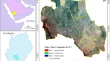
Spatial and decadal prediction of land use/land cover using multi-layer perceptron-neural network (MLP-NN) algorithm for a semi-arid region of Asir, Saudi Arabia Saeed AlqadhiJaved MallickPham Viet Hoa Research Article 24 June 2021 Pages: 1547 - 1562
Estimating parameters for the Van Genuchten model from soil physical-chemical properties of undisturbed loess-soil Wenjing QinGuisheng Fan Research Paper 18 August 2020 Pages: 1563 - 1570
Exploring the Indian summer monsoon rainfall through multifractal detrended fluctuation analysis and the principle of entropy maximization Sombit ChakrabortySurajit Chattopadhyay Methodology Article 11 June 2021 Pages: 1571 - 1577
Decentralized geospatial metadata management Cristiano FugazzaPaolo Tagliolato Acquaviva d’AragonaPaola Carrara Methodology Article 07 February 2021 Pages: 1579 - 1596
Context aware benchmarking and tuning of a TByte-scale air quality database and web service Clara BetancourtBjörn HagemeierMartin G. Schultz Methodology Article Open access 07 June 2021 Pages: 1597 - 1607
An eco‐city design methodology for hilly areas of western China Kai LinZhengwei HeLi He Methodology Article 04 March 2021 Pages: 1609 - 1623
Fuzzy binary relation based elucidation of air quality over a highly polluted urban region of India Goutami ChattopadhyaySurajit ChattopadhyaySubrata Kumar Midya Methodology Article 08 May 2021 Pages: 1625 - 1631
GNSS-IR-UT: A MATLAB-based software for SNR-based GNSS interferometric reflectometry (GNSS-IR) analysis Saeed FarzanehKamal ParvaziHadi Heydarizadeh Shali Software Article 23 June 2021 Pages: 1633 - 1645
Comparison of modified Waxman-Smith algorithms and Archie models in prospectivity analysis of saturations in shaly-sand reservoirs. A case study of Pennay field, Niger-Delta Akindeji O. FajanaMichael A. AyukTemitope D. Omoyegun Software Article 25 February 2021 Pages: 1647 - 1663
ATSAT: a MATLAB-based software for multi-satellite altimetry data analysis Saeed FarzanehKamal Parvazi Software Article 19 March 2021 Pages: 1665 - 1678
TZT: a windows program for calculating zircon crystallization temperature based on Ti-in-zircon thermometry Ahmed M. DardierOsama K. DessoukyMohammed Z. El-Bialy Software Article 05 March 2021 Pages: 1679 - 1684