Assessment and visualization of spatial interpolation of soil pH values in farmland Yi-Hwa WuMing-Chih HungJamie Patton OriginalPaper 10 May 2013 Pages: 565 - 585
Plant growth parameter estimation from sparse 3D reconstruction based on highly-textured feature points Ran Nisim LatiSagi FilinHanan Eizenberg OriginalPaper 23 May 2013 Pages: 586 - 605
Application of remote sensing and GIS for assessing economic loss caused by frost damage to tea plantations Weiping LouZongwei JiJianneng Zhou OriginalPaper 23 May 2013 Pages: 606 - 620
Comparison of chlorophyll fluorescence curves and texture analysis for automatic plant identification Heta MattilaPertti ValliEsa Tyystjärvi OriginalPaper 01 June 2013 Pages: 621 - 636
Ground-level hyperspectral imagery for detecting weeds in wheat fields I. HerrmannU. ShapiraD. J. Bonfil OriginalPaper 13 June 2013 Pages: 637 - 659
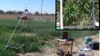
Using high resolution UAV thermal imagery to assess the variability in the water status of five fruit tree species within a commercial orchard V. Gonzalez-DugoP. Zarco-TejadaE. Fereres OriginalPaper 15 June 2013 Pages: 660 - 678