Recognition of debris flow, debris flood and flood hazard through watershed morphometrics D. J. WilfordM. E. SakalsW. A. Bergerud Original Paper 05 March 2004 Pages: 61 - 66
Assessing debris flow hazards associated with slow moving landslides: methodology and numerical analyses J.-P. MaletO. MaquaireA. Remaître Original Paper 03 March 2004 Pages: 83 - 90
Regional debris-flow distribution and preliminary risk assessment from severe storm events in the Appalachian Blue Ridge Province, USA G. F. WieczorekG. S. MossaB. A. Morgan Original Paper 27 February 2004 Pages: 53 - 59
Instability and geotechnical problems of the Buddha niches and surrounding cliff in Bamiyan Valley, central Afghanistan Claudio Margottini OriginalPaper 27 February 2004 Pages: 41 - 51
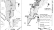
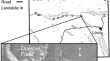
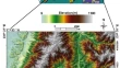
Three-dimensional mapping of a landslide using a multi-geophysical approach: the Quesnel Forks landslide A. BichlerP. BobrowskyR. Burns Original Paper 27 February 2004 Pages: 29 - 40
Ground-based SAR interferometry for monitoring mass movements G. AntonelloN. CasagliD. Tarchi Original Paper 27 February 2004 Pages: 21 - 28
Undrained dynamic-loading ring-shear apparatus and its application to landslide dynamics Kyoji SassaHiroshi FukuokaNaohide Ishikawa Original Paper 27 February 2004 Pages: 7 - 19
Landslide susceptibility mapping using GIS-based weighted linear combination, the case in Tsugawa area of Agano River, Niigata Prefecture, Japan Lulseged AyalewHiromitsu YamagishiNorimitsu Ugawa Original Paper 21 February 2004 Pages: 73 - 81
Extremely slow slope movements influencing the stability of Spis Castle, UNESCO site Jan Vlcko Original Paper 20 February 2004 Pages: 67 - 71