
Abstract
Towards the end of the Second World War, five agencies of the German Reich provided military geoscientific information on the Adriatic Theatre. First, military geology units of the Army High Command supported fortress engineers with written reports on sub-surface conditions, such as drinking water supply; raw materials and aggregates for fortification; and flood maps. Second, the Forschungsstaffel z.b.V., the Research Staff for Special Duty, provided terrain evaluation and off-road trafficability maps at scales of 1:100,000 and 1:200,000. Third, after the collapse of Axis partner Italy in October 1943, the construction agency Organisation Todt (OT) established positions along defensive lines crossing the northern Italian Apennines, such as the Green Line north of Florence, the Po Line, the Adige Line and the Blue Line west of Trieste. At present, it is unknown whether or not military geologists supported the Bauleitungen (works management offices) of the OT. Fourth, a few German geologists and mining engineers supported the Wehrgeologen-Bataillon 500, which reinforced fortifications on the former Alpine Wall in northern Italy. Fifth, military geologists of the SS supported the Karstwehr-Bataillon (later the 24 Waffen-Gebirgs-(Karstjäger-) Division der SS), which fought in northern Italy and was later accused of war crimes against partisans.
Access this chapter
Tax calculation will be finalised at checkout
Purchases are for personal use only
Notes
- 1.
‘z.b.V.’ is the abbreviation for ‘zur besonderen Verwendung’, which means for special utilisation by high military commands.
- 2.
Dr. Ing. Hans Brand (1879–1959) must not be mistaken for the German military geologist Dr. Erich Brand (1914–2011), see Häusler (1995b).
References
Blood PW (2006) Hitler’s bandit hunters: The SS and the Nazi occupation of Europe, 401. Potomac Books, Washington DC
Häusler H (1986) Die “historische” Rolle der Wünschelrute für Aufgaben der Angewandten Geologie. Mitteilungen der Gesellschaft der Geologie- und Bergbaustudenten 33:265-286
Häusler H. (1995a) Die Wehrgeologie im Rahmen der Deutschen Wehrmacht und Kriegswirtschaft. Teil 1: Entwicklung und Organisation. Informationen des Militärischen Geo-Dienstes vol 47. Bundesministerium für Landesverteidigung, Wien
Häusler H (1995b) Die Wehrgeologie im Rahmen der Deutschen Wehrmacht und Kriegswirtschaft. Teil 2: Verzeichnis der Wehrgeologen. Informationen des Militärischen Geo-Dienstes vol 48. Bundesministerium für Landesverteidigung, Wien
Häusler H (2000) Deployment and role of military geology teams in the German army 1941–45. In: Rose EPF, Nathanail CP (eds) Geology and warfare: examples of the influence of terrain and geologists on military operations. The Geological Society, London, p 159-175
Häusler H (2006) Historic maps of terrain evaluation. In: Mang R, Häusler H (eds) International Handbook Military Geography. Bundesministerium für Landesverteidigung, Wien, p 257-271
Häusler H (2007) Forschungsstaffel z.b.V. – Eine Sondereinheit zur militärgeografischen Beurteilung des Geländes im 2. Weltkrieg. MILGEO 21. Bundesministerium für Landesverteidigung, Wien
Häusler H (2011) The “Forschungsstaffel z.b.V.”, a special geoscientific unit of the German counter military intelligence service during the Second World War. In: Häusler H, Mang R (eds) International Handbook Military Geography (Proceedings of the 8th International Conference on Military Geosciences, June 15–19, 2009), 2:276-286. Bundesministerium für Landesverteidigung und Sport, Wien
Häusler H (2018a) Geographen im Zweiten Weltkrieg: Die “Forschungsstaffel z.b.V.”: Nutzung der Potenziale des Georaumes für Militärische Zwecke. Mitteilungen der Österreichischen Geographischen Gesellschaft 160:9-56. https://doi.org/10.1553/moegg160s9
Häusler H (2018b) Sonderkommando Dora – Special military geoscientific unit of the German counter-intelligence service in North Africa 1942. Scientia Militaria, South African Journal of Military Studies 46(1):37-57. https://doi.org/10.5787/46-1-1224
Häusler H (2019a) The northern Atlantic Wall: German engineering geology work in Norway during World War II. In: Rose EPF, Ehlen J, Lawrence UL (eds) Military aspects of geology: fortification, excavation and terrain evaluation. Special Publication 473. The Geological Society, London, p 83-108. https://doi.org/10.1144/SP473-16-061
Häusler H (2019b German military specialist maps of the north Italian theatre of war 1945. The 13th International Conference on Military Geosciences, Peace follows war: geosciences, territorial impacts and post-conflict reconstruction, Padova 24-28 June 2019, Abstract book. Societá Geologica Italiana, Roma, p 46. https://doi.org/10.3301/ABSGI.2019.03
Häusler H (2022) German Military Geography and Geology at the Eastern Front 1941-1945. In: Bondesan A, Ehlen J (eds) Military Geoscience: A multifaceted approach to the study of warfare, 978-3-030-79259-6, 490182_1
Häusler H, Willig D. (2000) Development of military geology in the German Wehrmacht 1939-45. In: Rose EPF, Nathanail CP (eds) Geology and Warfare: examples of the influence of terrain and geologists on military operations. The Geological Society, London, p 141-158
Hillgruber A, Hümmelchen G (1978) Chronik des Zweiten Weltkrieges – Kalendarium militärischer und politischer Ereignisse 1939–1945. Droste-Verlag, Düsseldorf
Höhne R (2020) https://de.wikipedia.org/wiki/Rolf_Höhne. Accessed 25 May 2020
Kaienburg H (2015) Der Militär- und Wirtschaftsstandort der SS im KZ-Standort Sachsenhausen-Oranienburg. Schnittpunkt von KZ-System, Waffen-SS und Judenmord. Schriftenreihe der Stiftung Brandenburgische Gedenkstätten, vol 16. Metropol Verlag, Berlin
Kaltenegger R (2008) Totenkopf & Edelweiß. General Artur Phleps und die südosteuropäischen Gebirgsverbände der Waffen-SS im Partisanenkampf auf dem Balkan 1942–1945. Ares Verlag, Graz
Kater MH (1974) Das “Ahnenerbe” der SS 1935-1945. Ein Beitrag zur Kulturpolitik des Dritten Reiches. Deutsche Verlags-Anstalt, Stuttgart
Kinder H, Hilgemann W (2000) dtv-Atlas Weltgeschichte. Deutscher Taschenbuch Verlag, München
Klietmann K-G (1965) Die Waffen-SS, eine Dokumentation. Verlag Der Freiwillige GMBH, Osnabrück
Klee E (2014) Das Personenlexikon zum Dritten Reich. Wer war was vor und nach 1945, 4. Auflage. Fischer Taschenbuch Verlag, Frankfurt am Main
Knolle F (2012) Materialien zur Geschichte der deutschen Höhlenkunde im Schatten des “Dritten Reiches”. Abhandlungen der Arbeitsgemeinschaft für Karstkunde in Niedersachsen e.V., 5:1-66. Eigenverlag der Arbeitsgemeinschaft für Karstkunde in Niedersachsen e.V. (Digitale Neuauflage des Heftes aus dem Jahr 1987), Osterode https://www.karstwanderweg.de/publika/argekaha/5/1-66/index.htm. Accessed 25 May 2020
Kresse W, Danko D (2012) Springer handbook of geographic information. Springer, Berlin
Lemmes F (2010) Zwangsarbeit im besetzten Europa. Die Organisation Todt in Frankreich und Italien, 1940–1945. In: Heusler A, Spoerer M, Trischler H (eds) Rüstung und Kriegswirtschaft im “Dritten Reich”. Schriftenreihe der BMW Group – Konzernarchiv 3. Oldenbourg Wissenschaftsverlag GmbH, München, p 219-252
Minott RG (1967) Top Secret. Hitlers Alpenfestung. Tatsachenbericht über einen Mythos. Rowohlt Taschenbuch Verlag, Reibek/Hamburg
Prokop O, Wimmer W (1985) Wünschelrute, Erdstrahlen, Radiästhesie. Die okkulten Strahlenfühlungslehren im Lichte der Wissenschaft. 3. völlig neu bearbeitete Auflage. Ferdinand Enke, Stuttgart
Reitzenstein J (2014) Himmlers Forscher. Wehrwissenschaft und Medizinverbrechen im »Ahnenerbe« der SS. Ferdinand Schöningh, Paderborn
Roscoe JH (1953) Photogrammetry. In: The Committee on Geophysics and Geography Research and Development Board (ed) Selected papers on photogeology and photo interpretation. Directorate of Intelligence, US Air Force, Washington DC
Schulte JE, Lieb P, Wegner B (2014) Die Waffen-SS. Neue Forschungen. Krieg in der Geschichte (KriG) vol 74. Ferdinand Schöningh, Paderborn
Seidler F (1987) Die Organisation Todt. Bauen für Staat und Wehrmacht 1938-1945. Bernard and Graefe, Koblenz
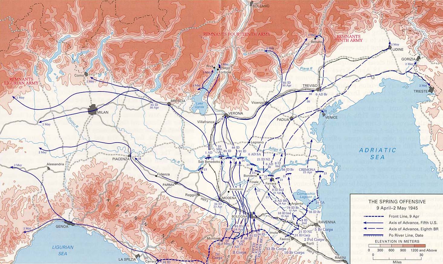
Spring Offensive Italy 1945. Wikimedia Commons. http://www.army.mil/cmh-pg/brochures/po/map2.JPG
Starr CG (1965) The Fortress that never was: The myth of Hitler’s Bavarian stronghold. The Journal of American History, 52(2):411-412
Stuhlpfarrer K (1969) Die Operationszonen „Alpenvorland“ und Adriatisches Küstenland“ 1943-1945. Publikationen des Österreichischen Instituts für Zeitgeschichte und des Instituts für Zeitgeschichte der Universität Wien, vol 7. Brüder Hollinek, Wien
Supreme Headquarters Allied Expeditionary Force, Counter-Intelligenc Sub-Division. (1945) Handbook of the Organisation Todt (OT). MIRS/MR-OT/5/45, 36. Military Intelligence Research Section, London https://archive.org/stream/HandbookOfTheOrganisationTODTOTUK1945/Handbook-of-the-organisation-TODT-O-T-UK-1945_djvu.txt. Accessed 25 May 2020
Swanston O, Swanston M (2007) The historical atlas of World War II. Cartographica Press Ltd./Chartwell Books, Inc., London
Tessin G (1970). Verbände und Truppen der deutschen Wehrmacht und Waffen-SS im Zweiten Weltkrieg 1939-1945. 4. Band, Die Landstreitkräfte. Biblio Verlag, Osnabrück, p 15-30
Tessin G (1980) Verbände und Truppen der deutschen Wehrmacht und Waffen-SS im Zweiten Weltkrieg 1939-1945, 14 vols. Biblio Verlag, Osnabrück
Tschudi E (1960) Die militärischen Operationen in Europa 1939-1945. Karte 1:5,000,000. Kümmerly and Frey, Bern
US Military Academy (USMA) (2020) Maps of Allied Offensives: Allied Offensives in Northern Italy (June 5 - December 31, 1944). https://www.jewishvirtuallibrary.org/map-of-allied-offensives-in-northern-italy-june-december-1944. Accessed 20 May 2020
Valente L (2007) I geologi di Himmler. L’SS-Wehrgeologen-Bataillon 500 tra Veneto e Trentino: dalla rappesaglia della Laita (Tretto di Schio, 30 novembre 1944) all’ipotesi Pedescala. Nuova serie, vol. 63. Cierre-Istrevi, Verona
Waffen-SS (2020). https://en.wikipedia.org/wiki/Waffen-SS. Accessed 25 May 2020
Wehrgeologenbataillon (2020) https://www.forum-der-wehrmacht.de/index.php?thread/3203-ss-wehrgeologen-btl-mot-500/. Accessed 25 May 2020
Wimmer J (1940) Zur Denkschrift des Reichsverbandes für das Wünschelrutenwesen (vom 6.10.1938) und zum Bericht des S.D. (ohne Datum). Manuscript, 12 Seiten, nach „Ahnenerbe: Documents from Nazi Germany, 1936-1945“ verfasst am 30. Oktober 1940. https://digitalcommons.ursinus.edu/dowsing/30. Accessed 25 May 2020
Acknowledgements
I thank Univ. Prof. Dr. Johann Robitsch (23.11.1912–10.4.1990) for providing information on SS military geology. Thanks are due to the support of the German Federal Archives, Militärarchiv in Freiburg im Breisgau and the Museum für Historische Wehrtechnik in Röthenbach an der Pegnitz, Bavaria. The author acknowledges Univ. Prof. Dr. Sven Fuchs, Vienna, Austria, for providing the maps prepared by the Forschungsstaffel and Uwe Kleinert, Berlin, for additional information on the Military Geology Corps of the Waffen-SS.
Author information
Authors and Affiliations
Corresponding author
Editor information
Editors and Affiliations
Rights and permissions
Copyright information
© 2022 Springer Nature Switzerland AG
About this chapter

Cite this chapter
Häusler, H. (2022). The Use of German Military Geology in the Adriatic Theatre 1943–1945. In: Bondesan, A., Ehlen, J. (eds) Military Geoscience: A Multifaceted Approach to the Study of Warfare. Advances in Military Geosciences. Springer, Cham. https://doi.org/10.1007/978-3-030-79260-2_13
Download citation
DOI: https://doi.org/10.1007/978-3-030-79260-2_13
Published:
Publisher Name: Springer, Cham
Print ISBN: 978-3-030-79259-6
Online ISBN: 978-3-030-79260-2
eBook Packages: Earth and Environmental ScienceEarth and Environmental Science (R0)